Windmill Islands
The Windmill Islands are an Antarctic group of rocky islands and rocks about 11.1 kilometres (6 nmi) wide, paralleling the coast of Wilkes Land for 31.5 kilometres (17 nmi) immediately north of Vanderford Glacier along the east side of Vincennes Bay. Kirkby Shoal is a small shoal area with depths of less than 18 metres (59 ft) extending about 140 metres (459 ft) westwards and SSW, about 3.4 kilometres (2.1 mi) from the summit of Shirley Island, Windmill Islands, and 0.24 kilometres (0.15 mi) NW of Stonehocker Point, Clark Peninsula.
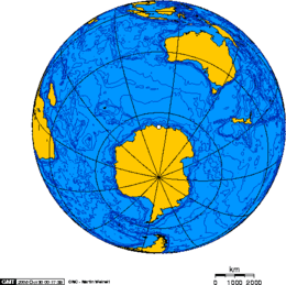
 Orthographic projection over the Windmill Islands | |
 Windmill Islands Location in Antarctica | |
| Geography | |
|---|---|
| Location | Vincennes Bay |
| Coordinates | 66°20′S 110°28′E |
| Administration | |
| Administered under the Antarctic Treaty System | |
| Demographics | |
| Population | Uninhabited |
The Windmill Islands were mapped from aerial photographs taken by USN Operation Highjump, 1946–47. So named by the US-ACAN because personnel of Operation Windmill, 1947–48, landed on Holl Island at the southwest end of the group to establish ground control for USN Operation Highjump photographs. The term "Operation Windmill" is a popular expression which developed after the expedition disbanded and refers to the extensive use of helicopters made by this group. The official title of this expedition was the 'Second Antarctic Development Project', U.S. Navy Task Force 39, 1947–48.
Features
Some of the main geographic features of the archipelago are:
- Austral Island[1]
- Kilby Island[2]
- Kirkby Shoal[3]
- Larsen Bank[4]
- McMullin Island[5]
- Molholm Island[6]
- Shirley Island[7]
See also
- Composite Antarctic Gazetteer
- List of Antarctic and sub-Antarctic islands
- List of Antarctic islands south of 60° S
- Newcomb Bay
- SCAR
- Territorial claims in Antarctica
References
- Austral Island - Geonames
- Kilby Island - Geonames
- "Kirkby Shoal". Geographic Names Information System. United States Geological Survey. Retrieved 2013-05-03.
- "Larsen Bank". Geographic Names Information System. United States Geological Survey. Retrieved 2013-05-31.
- "McMullin Island". Geographic Names Information System. United States Geological Survey. Retrieved 2013-09-10.
- "Molholm Island". Geographic Names Information System. United States Geological Survey. Retrieved 2013-10-29.
- Shirley Island - Geonames
External links
![]()