Wind Fell
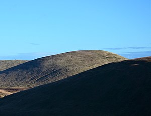
Wind Fell is a hill in the Ettrick Hills range, part of the Southern Uplands of Scotland. The Dumfries and Galloway-Scottish Borders border lies across the hill. Close to the Southern Upland Way, routes of ascent frequently incorporate its track and it is almost always climbed along with the neighbouring hills.[3]
| Wind Fell | |
|---|---|
 | |
| Highest point | |
| Elevation | 665 m (2,182 ft) [1] |
| Prominence | 90 m (300 ft) [1] |
| Listing | Tu,Sim,D,sHu,GT,DN [2] |
| Geography | |
| Location | Dumfries and Galloway, Scottish Borders, Scotland |
| Parent range | Ettrick Hills, Southern Uplands |
| OS grid | NT 17897 06166 |
| Topo map | OS Landranger 79 |
Subsidiary SMC Summits
| Summit | Height (m) | Listing[2] |
|---|---|---|
| Hopetoun Craig | 632 | Tu,Sim,DT,GT,DN[4] |
gollark: I *always* have the right idea.
gollark: Just allow RPNCalc access to all DOM functions.
gollark: Everything should handle either one thing, no things, or n things. No weird "up to 7 things" like (*ugh*) Elm.
gollark: It's not TC until you add a command doucmented as "making it Turing complete" and nothing else.
gollark: I am still spiting LyricLy by NOT BUYING TERRARIA!!!!
References
- "Wind Fell". www.hill-bagging.co.uk.
- "Database of British and Irish Hills: user guide". www.hills-database.co.uk.
- "Loch Fell". www.hill-bagging.co.uk.
- "Hopetoun Craig". www.hill-bagging.co.uk.
This article is issued from Wikipedia. The text is licensed under Creative Commons - Attribution - Sharealike. Additional terms may apply for the media files.