Wildnis Trail
The Wildnis Trail is a long-distance hiking path in the Eifel National Park in North Rhine-Westphalia, Germany. The path is 85 km long and leads through the entire national park from Southwest to Northeast. The trail brings the hiker through all different zones of the national park. These include forest, heath, grassland, artificial lakes and mountain streams.
| Wildnis Trail | |
|---|---|
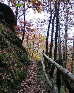 Wilderness Trail near Leykaul | |
| Length | 85 kilometres (53 mi) |
| Location | Eifel National Park, North Rhine-Westphalia, Germany |
| Established | 2007 |
| Trailheads | Höfen, Zerkall |
| Use | Hiking |
| Elevation | |
| Highest point | Wahlerscheid 628 metres (2,060 ft) |
| Lowest point | Zerkall 180 metres (590 ft) |
| Hiking details | |
| Season | Year round |
| Sights | Ordensburg Vogelsang |
| Website | http://www.nationalpark-eifel.de/go/eifel/english/Under_your_own_steam/Wilderness_Trail.html |
Stages
The national park proposes to complete the path in 4 one-day stages with each a length between 18 and 25 km.
- Höfen - Einruhr: 24,7 km
- Einruhr - Gemünd: 20,5 km
- Gemünd - Heimbach: 22,4 km
- Heimbach - Zerkall: 17,7 km
gollark: I do, however, have many ideas.
gollark: I am too cheap to pay money for one.
gollark: https://osmarks.tk/p3.html contains the latest, canonical, eternally relevant privacy policy.
gollark: No. OC also will not.
gollark: Replying to https://discord.com/channels/346530916832903169/348702212110680064/747422569912729661CC won't let me display it with formatting.
This article is issued from Wikipedia. The text is licensed under Creative Commons - Attribution - Sharealike. Additional terms may apply for the media files.