Westsound/WSX Seaplane Base
Westsound Seaplane Base (SPB) (IATA: WSX[2], FAA LID: WA83) is a seaplane base located adjacent to West Sound on Orcas Island in San Juan County, Washington, United States. It is owned by the Westsound Marina.[1]
Westsound Seaplane Base | |||||||||||||||
|---|---|---|---|---|---|---|---|---|---|---|---|---|---|---|---|
| Summary | |||||||||||||||
| Airport type | Private | ||||||||||||||
| Owner | Westsound Marina | ||||||||||||||
| Serves | West Sound, Washington | ||||||||||||||
| Elevation AMSL | 0 ft / 0 m | ||||||||||||||
| Coordinates | 48°37′05″N 122°57′24″W | ||||||||||||||
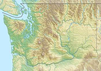
| Map | |||||||||||||||
 WSX Location of airport in Washington | |||||||||||||||
| Runways | |||||||||||||||
| |||||||||||||||
Facilities
Westsound Seaplane Base has two seaplane landing areas: 10/28 is 4,000 by 500 feet (1,219 x 152 m) and 18/36 is 5,000 by 500 feet (1,524 x 152 m).[1]
Airlines and destinations
- Kenmore Air (Seattle) [3]
gollark: Cows are no longer present.
gollark: Cows are present.
gollark: Observe:
gollark: I made a spell which disappears cows.
gollark: Contingency 33B is being activated.
References
- FAA Airport Master Record for WA83 (Form 5010 PDF). Federal Aviation Administration. Effective 29 July 2010.
- "Alaska Airlines Partnership FAQ (includes IATA codes)". Kenmore Air. Archived from the original on 26 December 2010. Retrieved 28 August 2010.
- "San Juan Islands Seaplane Schedule, May 1-June 24, 2010". Kenmore Air. Archived from the original on 7 May 2010. Retrieved 28 August 2010.
External links
- Resources for this airport:
- FAA airport information for WA83
- AirNav airport information for WA83
- ASN accident history for WSX
- FlightAware airport information and live flight tracker
- SkyVector aeronautical chart for WA83
This article is issued from Wikipedia. The text is licensed under Creative Commons - Attribution - Sharealike. Additional terms may apply for the media files.