Westmere, New Zealand
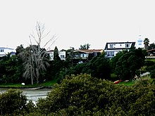
Westmere is a residential suburb of Auckland City, New Zealand. Westmere is under the local governance of the Auckland Council. The suburb was originally a working-class area, containing some state houses; mostly private housing originating from housing development in the 1920s. It is known for its Californian style bungalow architecture. It is now a highly sought-after residential location with extensive redevelopment.
Westmere | |
|---|---|
Suburb | |

| |
| Country | New Zealand |
| Local authority | Auckland Council |
| Electoral ward | Waitematā and Gulf Ward |
| Population (2018) | |
| • Total | 2,343 |
| Postcode(s) | 1022 |
| Airport(s) | None |
| Hospitals(s) | None |
| (Waitematā Harbour) | (Coxs Bay, Waitematā) | Herne Bay, (Coxs Bay) |
| Point Chevalier |
|
Ponsonby |
| Point Chevalier | Western Springs | Grey Lynn |
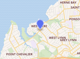
Westmere is broadly bisected by Garnet Road and is bounded by Coxs Bay to the North and the green belt running from Western Springs, the Auckland Zoo and Western Springs College to the South and West.
In 2016 Auckland Transport proposed significant changes to Westmere's main roads (Garnet Road, Old Mill Road, etc.) to create safer infrastructure for cyclists, with physically-separate cycle lanes, making safe daily travel between homes and schools even easier than currently.
Demographics
| Year | Pop. | ±% p.a. |
|---|---|---|
| 2006 | 2,148 | — |
| 2013 | 2,295 | +0.95% |
| 2018 | 2,343 | +0.41% |
| Source: [1] | ||

The statistical area of Westmere North is slightly smaller than the suburb, which extends into the statistical area of Westmere South-Western Springs. It had a population of 2,343 at the 2018 New Zealand census, an increase of 48 people (2.1%) since the 2013 census, and an increase of 195 people (9.1%) since the 2006 census. There were 756 households. There were 1,143 males and 1,200 females, giving a sex ratio of 0.95 males per female. The median age was 40.5 years, with 489 people (20.9%) aged under 15 years, 438 (18.7%) aged 15 to 29, 1,161 (49.6%) aged 30 to 64, and 255 (10.9%) aged 65 or older.
Ethnicities were 86.3% European/Pākehā, 8.1% Māori, 5.1% Pacific peoples, 9.2% Asian, and 2.2% other ethnicities (totals add to more than 100% since people could identify with multiple ethnicities).
The proportion of people born overseas was 20.4%, compared with 27.1% nationally.
Although some people objected to giving their religion, 59.0% had no religion, 30.2% were Christian, and 6.7% had other religions.
Of those at least 15 years old, 897 (48.4%) people had a bachelor or higher degree, and 159 (8.6%) people had no formal qualifications. The median income was $53,600. The employment status of those at least 15 was that 1,038 (56.0%) people were employed full-time, 315 (17.0%) were part-time, and 51 (2.8%) were unemployed.[1]
Schools
Westmere School is a coeducational contributing primary (years 1-6) school with a roll of 479 as of March 2020.[2][3]
Pasadena Intermediate School in Point Chevalier is well within walking/cycling distance for students in between primary and secondary. The closest State secondary school is Western Springs College (other options are Avondale College and Mount Albert Grammar School).
References
- "Statistical area 1 dataset for 2018 Census". Statistics New Zealand. March 2020. Westmere North (129800). 2018 Census place summary: Westmere North
- "New Zealand Schools Directory". New Zealand Ministry of Education. Retrieved 26 April 2020.
- Education Counts: Westmere School
External links
- Photographs of Westmere held in Auckland Libraries' heritage collections.