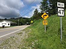
West Virginia Route 47
West Virginia Route 47 is an east–west state highway in northern West Virginia. The western terminus of the route is at WV 618 (former US 50) in Parkersburg. The eastern terminus is at U.S. Route 33 and U.S. Route 119 in Linn.
| ||||
|---|---|---|---|---|
| Route information | ||||
| Maintained by WVDOH | ||||
| Length | 62.5 mi[1] (100.6 km) | |||
| Major junctions | ||||
| West end | ||||
| ||||
| East end | ||||
| Location | ||||
| Counties | ||||
| Highway system | ||||
| ||||

Major intersections
| County | Location | mi | km | Destinations | Notes |
|---|---|---|---|---|---|
| Wood | Parkersburg | Western terminus | |||
| | interchange | ||||
| | I‑77 Exit 174 | ||||
| Ritchie | | ||||
| Smithville | West end of WV 16 overlap | ||||
| East end of WV 16 overlap | |||||
| Gilmer | Coxs Mills | ||||
| | |||||
| Linn | Eastern terminus | ||||
1.000 mi = 1.609 km; 1.000 km = 0.621 mi
| |||||
gollark: What would I do with a speech to speech system? That would be silly.
gollark: Why?
gollark: Maybe I should spy on them with a speech to text to speech system.
gollark: Oh, that makes sense.
gollark: I don't remember them saying that.
See also
- List of state highways in West Virginia
- List of highways numbered 47
References
- Distance calculated using Microsoft MapPoint mapping software.
This article is issued from Wikipedia. The text is licensed under Creative Commons - Attribution - Sharealike. Additional terms may apply for the media files.