West Virginia Route 41
West Virginia Route 41 (WV 41) is a 64.8-mile-long (104.3 km) north–south state highway in the central part of the U.S. state of West Virginia. Its southern terminus is at WV 210 in Beckley. Its northern terminus is at WV 55 about 1 mile (1.6 km) west of Calvin.
| ||||
|---|---|---|---|---|
| Route information | ||||
| Maintained by WVDOH | ||||
| Length | 64.8 mi[1] (104.3 km) | |||
| Major junctions | ||||
| South end | ||||
| ||||
| North end | ||||
| Location | ||||
| Counties | Raleigh, Fayette, Nicholas | |||
| Highway system | ||||
| ||||

_at_U.S._Route_19_in_Summersville%2C_Nicholas_County%2C_West_Virginia.jpg)
View north along WV 41 at US 19 in Summersville
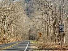
WV 41 in Prince
South of Summersville, WV 41 follows the route of U.S. Route 19 (US 19) prior to the construction of Corridor L of the Appalachian Development Highway System.
Major intersections
| County | Location | mi | km | Destinations | Notes |
|---|---|---|---|---|---|
| Raleigh | Beckley | Southern terminus | |||
| Southern end of US 19 concurrency | |||||
| Northern end of US 19 concurrency | |||||
| | Southern terminus of WV 61 | ||||
| Fayette | | Southern end of US 60 concurrency | |||
| | Northern end of US 60 concurrency | ||||
| Nicholas | Mount Nebo | Eastern terminus of WV 129 | |||
| | Southern end of US 19 concurrency | ||||
| Summersville | Northern end of US 19 concurrency | ||||
| Southern end of WV 39 concurrency | |||||
| Northern end of WV 39 concurrency | |||||
| | Northern terminus | ||||
1.000 mi = 1.609 km; 1.000 km = 0.621 mi
| |||||
gollark: I don't know. Intel's documentation doesn't say what advantage Garfield Peak has over Cyclone Peak.
gollark: <@787746801800577034> is now declared isomorphic.
gollark: You must have copied it off the interwebs.
gollark: Ideally² we would also be able to test things like this in test subnations, but nobody seems very interested in doing that.
gollark: Troubling.
See also

References
- Distance calculated using Microsoft MapPoint mapping software.
This article is issued from Wikipedia. The text is licensed under Creative Commons - Attribution - Sharealike. Additional terms may apply for the media files.