West Virginia Route 331
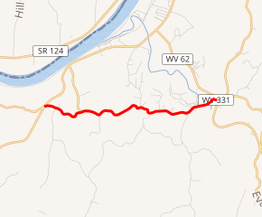
West Virginia Route 331 (WV 331) is an east–west state highway located entirely in Jackson County, West Virginia. The western terminus of the route is at West Virginia Route 2 and West Virginia Route 62 in Mount Alto. The eastern terminus is at WV 62 near Cottageville.
| ||||
|---|---|---|---|---|
WV 331 highlighted in red | ||||
| Route information | ||||
| Maintained by WVDOH | ||||
| Length | 4.0 mi[1] (6.4 km) | |||
| Major junctions | ||||
| West end | ||||
| East end | ||||
| Location | ||||
| Counties | Jackson | |||
| Highway system | ||||
| ||||

_at_West_Virginia_State_Route_2_in_Mount_Alto%2C_Jackson_County%2C_West_Virginia.jpg)
View east along WV 331 at WV 2 in Mount Alto
WV 331 is a former alignment of U.S. Route 33, which was later moved to follow all of present WV 62 between Mason and Ripley.
Major intersections
The entire route is in Jackson County.
| Location | mi | km | Destinations | Notes | |
|---|---|---|---|---|---|
| Mount Alto | |||||
| | |||||
| 1.000 mi = 1.609 km; 1.000 km = 0.621 mi | |||||
gollark: ++remind 10d * bet
gollark: ++remind 10d <@332271551481118732> [REDACTED] bdt
gollark: You can substitute it safely unless Lyricly. And Lyricly bad.
gollark: Controversial opinion: most ZISCs are just disguised OISCs.
gollark: I see.
References
- Google (January 18, 2014). "West Virginia Route 331" (Map). Google Maps. Google. Retrieved January 18, 2014.
| Wikimedia Commons has media related to West Virginia Route 331. |
This article is issued from Wikipedia. The text is licensed under Creative Commons - Attribution - Sharealike. Additional terms may apply for the media files.