West Virginia Route 15
West Virginia Route 15 is an east–west state highway in the central portion of the U.S. state of West Virginia. The western terminus of the route is at West Virginia Route 4 northeast of Sutton, Braxton County. The eastern terminus is at U.S. Route 219 and West Virginia Route 55 in Valley Head, Randolph County.
| ||||
|---|---|---|---|---|
| Route information | ||||
| Maintained by WVDOH | ||||
| Length | 64.1 mi[1] (103.2 km) | |||
| Major junctions | ||||
| West end | ||||
| East end | ||||
| Location | ||||
| Counties | Braxton, Webster, Randolph | |||
| Highway system | ||||
| ||||

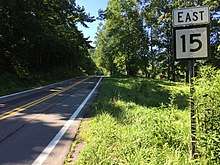
View east along WV 15 at CR 5/3 in Guardian
Major intersections
| County | Location | mi | km | Destinations | Notes |
|---|---|---|---|---|---|
| Braxton | Laurel Fork | ||||
| Webster | | west end of WV 20 overlap | |||
| Webster Springs | east end of WV 20 overlap | ||||
| Randolph | Valley Head | ||||
1.000 mi = 1.609 km; 1.000 km = 0.621 mi
| |||||
gollark: ... at least it's local time?
gollark: ++remind 2022 challenge
gollark: I wonder if ABR gets it right.
gollark: I'll do it when the bees in my walls tell me to, okay?
gollark: This should be complete before 2022.
References
- Distance calculated using Microsoft MapPoint mapping software.
| Wikimedia Commons has media related to West Virginia Route 15. |
This article is issued from Wikipedia. The text is licensed under Creative Commons - Attribution - Sharealike. Additional terms may apply for the media files.