West Branch Oswegatchie River
The West Branch Oswegatchie River is a river in Herkimer, Lewis, and St. Lawrence counties in New York. It starts at the outlet of Hog Pond and flows into the Oswegatchie River near the hamlet of Talcville. The West Branch Oswegatchie River is slower-moving than the Middle Branch, which flows into it. But the still waters such as Long Pond, Round Pond, Rock Pond, Mud Pond and Long Level are separated by hard-to-traverse rapids and/or waterfalls.[2]
| West Branch Oswegatchie River | |
|---|---|
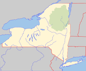 Location of the mouth of the West Branch Oswegatchie River  West Branch Oswegatchie River (the United States) | |
| Location | |
| Country | United States |
| State | New York |
| Counties | Herkimer, Lewis, St. Lawrence |
| Physical characteristics | |
| Source | Hog Pond |
| • location | NNE of Moshier Falls |
| • coordinates | 43°59′16″N 75°04′02″W |
| Mouth | Oswegatchie River |
• location | Talcville |
• coordinates | 44°18′02″N 75°19′55″W[1] |
• elevation | 595 ft (181 m) |
| Basin size | 280 sq mi (730 km2) |
| Basin features | |
| Tributaries | |
| • right | Middle Branch Oswegatchie River |
Tributaries
Right
Moncrief Creek
Hogs Back Creek
Desert Creek
Trout Lake
Blue Swamp Creek
Blanchard Creek
Kimball Creek
Middle Branch Oswegatchie River
South Creek
Meadow Brook
Big Creek
Toothaker Creek
Mott Creek
Bennett Brook
Left
Compo Creek
Pine Creek
Oswegatchie Creek
Clear Creek
Black Creek
Hall Creek
gollark: They assumed countries would act sanely.They were wrong.
gollark: I'm sure you can probably work out a better system if you don't go around confining it to either extreme.
gollark: Wiping out everything which ever has, will and could exist is much more efficient.
gollark: 0/10 - does not destroy entire totality of existence.
gollark: There's probably a more efficient way than just falling, at least.
References
- "West Branch Oswegatchie River". Geographic Names Information System. United States Geological Survey. Retrieved 2018-10-03.
- "West Branch Oswegatchie River". usgs.gov. usgs. 1998. Retrieved 18 April 2017.
data
This article is issued from Wikipedia. The text is licensed under Creative Commons - Attribution - Sharealike. Additional terms may apply for the media files.