Watts Hill
Watts Hill is a hill in the Dorset Downs and one of the highest in the county of Dorset, England. The height of the summit is variously recorded as 261 metres[2] or 262 metres.[1]
| Watts Hill | |
|---|---|
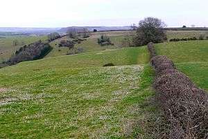 View across Watts Hill, close to the C12, with Whitcombe Bottom just beyond. | |
| Highest point | |
| Elevation | 262 m (860 ft) [1] |
| Prominence | 69 m (226 ft) [1] |
| Parent peak | Lewesdon Hill [1] |
| Coordinates | 50°49′54″N 2°27′53″W |
| Geography | |
| Location | Dorset, England |
| Parent range | Dorset Downs |
| OS grid | ST673036 |
| Topo map | OS Landranger 194 Explorer No. 117 |
Location
Watts Hill lies about 1½ miles north of Cerne Abbas above the village of Minterne Parva, and about 12 kilometres north of Dorchester, the county town. It is the highest point on a north-south ridge, on the southern spur of which is the Cerne Abbas Giant, an old landmark whose origin is unclear. A mile to the northwest is Dogbury Hill and, on the far side of the A352 is Telegraph Hill and High Stoy, a popular filming location.[2]
History
There is much evidence of prehistoric settlement in the area. Near the Giant there are the remains of an ancient settlement, a tumulus and an earthwork on the southern spur near Cerne Abbas, and similar features further north near Dogbury.[2]
References
- Summit Listings by Relative Height collated by Jonathan de Ferranti. Accessed on 30 Mar 2013.
- Ordnance Survey 1:50,000 Landranger series, No. 194