Wan Yai District
Wan Yai (Thai: หว้านใหญ่, pronounced [wâːn jàj]) is a district (amphoe) of Mukdahan Province, northeastern Thailand.
Wan Yai หว้านใหญ่ | |
|---|---|
.jpg) Our Lady of the Martyrs of Thailand Shrine at Pong Kham | |
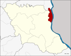 District location in Mukdahan Province | |
| Coordinates: 16°43′39″N 104°44′20″E | |
| Country | Thailand |
| Province | Mukdahan |
| Seat | Wan Yai |
| Area | |
| • Total | 84.48 km2 (32.62 sq mi) |
| Population (2005) | |
| • Total | 18,683 |
| • Density | 221.2/km2 (573/sq mi) |
| Time zone | UTC+7 (ICT) |
| Postal code | 49150 |
| Geocode | 4906 |
Geography
Neighboring districts are (from the south clockwise) Mueang Mukdahan of Mukdahan Province and That Phanom of Nakhon Phanom Province. To the east across the Mekong River is the Laotian province of Savannakhet.
The important water resource is the Mekong.
History
The minor district (king amphoe) Wan Yai was created on 16 September 1977, when the tambon Wan Yai, Pong Kham, and Bang Sai Noi were split off from Mukdahan District.[1] In 1982 it was one of six districts which formed the new province of Mukdahan. The minor district was upgraded to a full district on 9 May 1992.[2]
Administration
The district is divided into five sub-districts (tambon), which are further subdivided into 44 villages (muban). There are no municipal (thesaban) areas, and four tambon administrative organization (TAO).
| No. | Name | Thai name | Villages | Pop. | |
|---|---|---|---|---|---|
| 1. | Wan Yai | หว้านใหญ่ | 11 | 4,739 | |
| 2. | Pong Kham | ป่งขาม | 11 | 5,337 | |
| 3. | Bang Sai Noi | บางทรายน้อย | 11 | 4,715 | |
| 4. | Chanot | ชะโนด | 5 | 2,444 | |
| 5. | Dong Mu | ดงหมู | 6 | 1,448 |
References
- ประกาศกระทรวงมหาดไทย เรื่อง แบ่งท้องที่อำเภอมุกดาหาร จังหวัดนครพนม ตั้งเป็นกิ่งอำเภอหว้านใหญ่ (PDF). Royal Gazette (in Thai). 94 (89 ง): 3922. September 27, 1977.
- พระราชกฤษฎีกาตั้งอำเภอสอยดาว อำเภอโพนสวรรค์ อำเภอบางขัน อำเภอหว้านใหญ่ อำเภอเมืองปาน อำเภอภูหลวง อำเภอโคกศรีสุพรรณ และอำเภอสำโรง พ.ศ. ๒๕๓๕ (PDF). Royal Gazette (in Thai). 109 (45 ก): 27–29. April 9, 1992.