Wan Dam, Akola
Wan dam is located on wan river at the site of Wari village in Telhara Taluka of Akola District in Maharashtra, India. This is one of the largest irrigation projects in the Indian state of Maharashtra. The water is mainly used to irrigate agricultural land in the western vidarbha. It also provides water for drinking to near by towns, villages and Cities like Akola, Telhara Shegaon.The surrounding area of the dam has a garden old Hanumana temple.
| Wan Dam |
|---|
| Wan dam | |
|---|---|
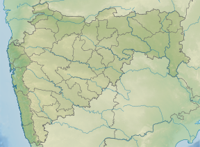 Location of Wan dam in Maharashtra | |
| Official name | Wan dam D03007 |
| Location | Telhara |
| Coordinates | 21.183611°N 76.804047°E |
| Opening date | 2000[1] |
| Owner(s) | Government of Maharashtra, India |
| Dam and spillways | |
| Type of dam | Earthfill Gravity |
| Impounds | Wan river |
| Height | 67.65 m (221.9 ft) |
| Length | 500 m (1,600 ft) |
| Dam volume | 599 km3 (144 cu mi) |
| Reservoir | |
| Creates | Hanuman Sagar |
| Total capacity | .081 km3 (0.019 cu mi) |
| Surface area | 4,391 km2 (1,695 sq mi) |
| Power Station | |
| Installed capacity | 1.5 MW |
Specifications
The height of the dam above its lowest foundation is 67.65 m (221.9 ft) while the length is 500 m (1,600 ft). The volume content is 599 km3 (144 cu mi) and gross storage capacity is 0.081 km3 (0.019 cu mi).[2]
Purpose
- Irrigation
- Hydroelectricity
- Water supply
gollark: @OrangeC7 As a Chorus City resident, do you have suggestions for useful infrastructure? I was thinking about physical street signs which could also display news.
gollark: MEH!
gollark: It's not unique to Keansia! Chorus City has this by default by not using town claims!
gollark: That applies to literally any other land you claim!
gollark: Anyway, Keanu, seriously?
See also
- Dams in Maharashtra
- List of reservoirs and dams in India
- Wan Hydroelectric Project
References
- "Wan D03007". Retrieved 3 April 2013.
- Specifications of large dams in India
This article is issued from Wikipedia. The text is licensed under Creative Commons - Attribution - Sharealike. Additional terms may apply for the media files.