Vinitsa Cove
Vinitsa Cove (Bulgarian: залив Виница, ‘Zaliv Vinitsa’ \'za-liv 'vi-ni-tsa\) is the 3.75 km wide cove indenting for 1.9 km Davis Coast in Graham Land, Antarctica east of Cape Page and west of Havilland Point. The cove is named after the settlement of Vinitsa in Southern Bulgaria.
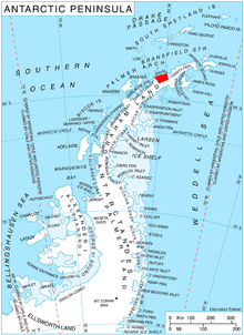
Location of Davis Coast.
Location
Vinitsa Cove is centred at 63°55′00″S 60°15′30″W. British mapping in 1978.
Maps
- British Antarctic Territory. Scale 1:200000 topographic map. DOS 610 Series, Sheet W 64 60. Directorate of Overseas Surveys, Tolworth, UK, 1978.
- Antarctic Digital Database (ADD). Scale 1:250000 topographic map of Antarctica. Scientific Committee on Antarctic Research (SCAR), 1993–2016.
gollark: Though over here they're mostly just used on mobile phone connections, not home ones.
gollark: Data caps do kind of work well at getting people to use less *bandwidth* because people don't use their internet connection as much, but they don't actually have some finite amount of internets or something weird like that.
gollark: Though you do need sensible small parties in the first place.
gollark: Probably less so, if you can vote for a popular party you like less and a less popular one you like more. It reduces the "I don't like either big party but I'm voting for the least bad one" thing.
gollark: Also, it isn't considered that as far as I'm aware since you are not actually (explicitly) ranking options.
References
- Bulgarian Antarctic Gazetteer. Antarctic Place-names Commission. (details in Bulgarian, basic data in English)
- Vinitsa Cove. SCAR Composite Antarctic Gazetteer.
External links
- Vinitsa Cove. Copernix satellite image
This article includes information from the Antarctic Place-names Commission of Bulgaria which is used with permission.
This article is issued from Wikipedia. The text is licensed under Creative Commons - Attribution - Sharealike. Additional terms may apply for the media files.