Vermont Route 4A
Vermont Route 4A (VT 4A) is a 14.174-mile-long (22.811 km) east–west state highway in Rutland County, Vermont, United States. It runs from Fair Haven to West Rutland. VT 4A was the former alignment of U.S. Route 4 (US 4) before it was relocated to an expressway.
| ||||
|---|---|---|---|---|
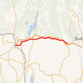
Vermont Route 4A highlighted in red | ||||
| Route information | ||||
| Auxiliary route of US 4 | ||||
| Maintained by VTrans | ||||
| Length | 14.174 mi[1] (22.811 km) | |||
| Existed | 1971[2]–present | |||
| Major junctions | ||||
| West end | ||||
| East end | ||||
| Location | ||||
| Counties | Rutland | |||
| Highway system | ||||
State highways in Vermont
| ||||

Route description
VT 4A begins at exit 1 of a four-lane U.S. Route 4 and goes into Fair Haven. It joins up with VT 22A and forms a brief concurrency in the center of town. The route then goes through the towns of Castleton (where it is known as Main Street and goes past Castleton University), Ira and West Rutland. The route ends at U.S. Route 4 Business in West Rutland.
Major intersections
The entire route is in Rutland County. [1]
| Location[1] | mi[1] | km | Destinations | Notes | |
|---|---|---|---|---|---|
| Fair Haven | 0.000 | 0.000 | Western terminus; exit 1 on US 4 | ||
| 1.505 | 2.422 | Western end of concurrency with VT 22A | |||
| 1.845 | 2.969 | Eastern end of concurrency with VT 22A | |||
| Castleton | 5.059 | 8.142 | |||
| West Rutland | 13.952 | 22.454 | Northern terminus of VT 133 | ||
| 14.174 | 22.811 | Eastern terminus; to | |||
1.000 mi = 1.609 km; 1.000 km = 0.621 mi
| |||||
gollark: Also, it's easier to autogenerate.
gollark: But you don't have to program that bit.
gollark: Yes.
gollark: Maybe I should make a mildly easier "Jsolangs", which would use JSON as an encoding and skip all the "parsing" nonsense.
gollark: Oh, no, it doesn't, it's fine.
References
- Traffic Research Unit (May 2013). "2012 (Route Log) AADTs for State Highways" (PDF). Policy, Planning and Intermodal Development Division, Vermont Agency of Transportation. Retrieved March 9, 2015.
- "Old Castleton Highway to be Called Route 4A". The Bennington Banner. November 1, 1971. p. 14. Retrieved November 4, 2015 – via Newspapers.com.

External links
| Wikimedia Commons has media related to Vermont Route 4A. |
This article is issued from Wikipedia. The text is licensed under Creative Commons - Attribution - Sharealike. Additional terms may apply for the media files.