Vendel, Ille-et-Vilaine
Vendel (Breton: Gwennel, Gallo: Vandèu) is a former commune in the Ille-et-Vilaine department in Brittany in northwestern France. On 1 January 2019, it was merged into the new commune Rives-du-Couesnon.[2]
Vendel Gwennel | |
|---|---|
Part of Rives-du-Couesnon | |
The church in Vendel | |
 Coat of arms | |
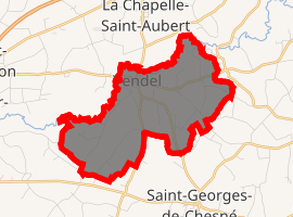
Location of Vendel 
| |
 Vendel  Vendel | |
| Coordinates: 48°18′00″N 1°18′37″W | |
| Country | France |
| Region | Brittany |
| Department | Ille-et-Vilaine |
| Arrondissement | Fougères-Vitré |
| Canton | Fougères-1 |
| Commune | Rives-du-Couesnon |
| Area 1 | 6.37 km2 (2.46 sq mi) |
| Population (2017)[1] | 393 |
| • Density | 62/km2 (160/sq mi) |
| Time zone | UTC+01:00 (CET) |
| • Summer (DST) | UTC+02:00 (CEST) |
| Postal code | 35140 |
| Elevation | 50–105 m (164–344 ft) |
| 1 French Land Register data, which excludes lakes, ponds, glaciers > 1 km2 (0.386 sq mi or 247 acres) and river estuaries. | |
Geography
Vendel is located 38 km (24 mi) northeast of Rennes and 45 km (28 mi) south of Mont Saint-Michel.
The adjacent communes are La Chapelle-Saint-Aubert, Billé, Saint-Georges-de-Chesné, and Saint-Jean-sur-Couesnon.
Population
Inhabitants of Vendel are called Vendelais in French.
| Year | Pop. | ±% |
|---|---|---|
| 1962 | 334 | — |
| 1968 | 344 | +3.0% |
| 1975 | 325 | −5.5% |
| 1982 | 300 | −7.7% |
| 1990 | 311 | +3.7% |
| 1999 | 339 | +9.0% |
| 2009 | 436 | +28.6% |
gollark: They're mostly designed for computer vision but you can run kit neural networks™ on them with hacks.
gollark: Yes, we run the "kit"/"aouwt" neural networks on these.
gollark: How do you have an "atomic" function?
gollark: What?
gollark: I've narrowed the issue down to my DNS provider, which is beeing somehow.
References
- Téléchargement du fichier d'ensemble des populations légales en 2017, INSEE
- Arrêté préfectoral 17 October 2018 (in French)
This article is issued from Wikipedia. The text is licensed under Creative Commons - Attribution - Sharealike. Additional terms may apply for the media files.