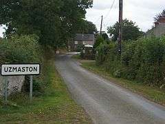
Uzmaston
Uzmaston is a small parish[1] in Pembrokeshire, Wales, about 2 kilometres south-east of Haverfordwest. The village, to the northwest of Boulston, forms part of the community of Uzmaston, Boulston and Slebech, and lies near the bank of the Western Cleddau.[2][3] It contains the Grade II listed St. Ismael's Parish Church which has existed since at least 1230, and was extensively rebuilt in 1870-73 and restored in the 1990s.
| Uzmaston | |
|---|---|
 Uzmaston | |
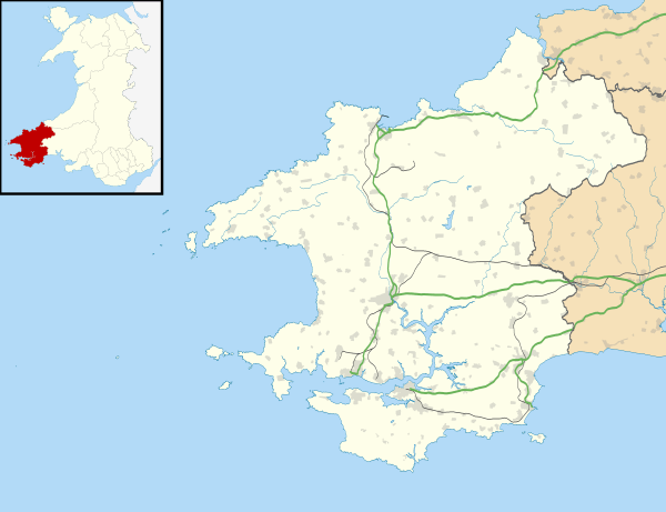 Uzmaston Location within Pembrokeshire | |
| OS grid reference | SM969144 |
| Community |
|
| Principal area | |
| Country | Wales |
| Sovereign state | United Kingdom |
| Police | Dyfed-Powys |
| Fire | Mid and West Wales |
| Ambulance | Welsh |
History
Historically, Uzmaston and the surrounding parish belonged to the Hundred of Dungleddy.[2] In 1993, five Roman coins were unearthed behind the church at Uzmaston.[4] At the time of the 1851 census, Uzmaston belonged to a parish comprishing an area of 2,070 acres with a population of 683 people, 307 male and 376 female.[5]
Landmarks
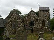
Its parish church is dedicated to the 6th-century Breton prince and Welsh saint Isfael. In 1230 it was granted to Wizo the Fleming. It was extensively rebuilt in 1870-73 and renovated in 1991-92. It was further restored in 1999[6] by Hereford architect Lingen Barker.[7] It became a Grade II listed building on 16 July 2004.[8] There is a house on the edge of Uzmaston along the lane from Boulton named "The Cottage".[3] There are the ruins of a cottage between the main lane and the Cleddau, just to the southwest of the village.[9]
Land
Samuel Lewis, writing in his A Topographical Dictionary of Wales, stated that Uzmaston "comprises a moderate extent of enclosed and cultivated land: the soil is generally fertile, and the inhabitants are chiefly employed in agriculture. The western part of it, containing the straggling extemity of a suburb of Haverfordwest, called Cartlett, is included within the new electoral limits of that borough.[2]
Geologically, the area is known for the yellow-grey[10] Uzmaston Beds, dated to the Silurian period,[11] which are unfossiliferous in the lower parts.[12]
References
- "Uzmaston". Genuki.org.uk. Retrieved 16 February 2016.
- Lewis, Samuel (1840). A Topographical Dictionary of Wales. p. 480.
- Google (3 September 2019). "Uzmaston" (Map). Google Maps. Google. Retrieved 3 September 2019.
- Peter Guest, Nicholas Wells, Nick Wells (2007). Iron age and Roman coins from Wales. Moneta.CS1 maint: uses authors parameter (link)
- The Religious Census of 1851, a Calendar of the Returns Relating to Wales: South Wales. General Register Office, University of Wales Press. 1976. p. 425.
- ST ISMAEL'S CHURCH, UZMASTON. Coflein. Retrieved 3 September 2019.
- Thornhill Timmins, H. Nooks and Corners of Pembrokeshire. BOD. p. 185.
- "Church of Saint Ismael". British Listed Buildings. Retrieved 3 September 2019.
- "Ruined cottage near Uzmaston". Geograph. Retrieved 3 September 2019.
- Proceedings. Geologist's Association. 1972. p. 151.
- Europe. Centre national de la recherche scientifique. 1956. p. 248.
- Special Papers, Issues 152-156. Geological Society of America. 1974. p. 70.
External links
| Wikimedia Commons has media related to Uzmaston. |