Utah State Route 17
State Route 17 (SR-17) is a state highway in southern Utah, running for 6.060 miles (9.753 km) in Washington County from La Verkin to Anderson Junction near Toquerville. It serves as a shortcut from I-15 to Zion National Park.[2]
| ||||
|---|---|---|---|---|
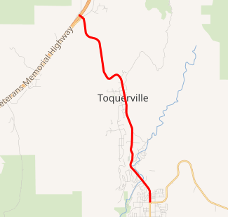
SR-17 highlighted in red | ||||
| Route information | ||||
| Defined by Utah Code §72-4-107 | ||||
| Maintained by UDOT | ||||
| Length | 6.060 mi[1] (9.753 km) | |||
| Existed | 1969–present | |||
| Major junctions | ||||
| South end | ||||
| North end | ||||
| Highway system | ||||
| ||||

Route description
The route begins at the junction of State Street and 500 North in the center of La Verkin and heads north on the latter, a two-lane undivided highway. After exiting La Verkin, the road turns northwest. South of Toquerville, the route curves between a north-northeast and north-northwest direction before steadying to a north-northeast direction. The route turns north-northwest and enters Toquerville as Toquer Boulevard. Exiting the town, the highway turns to the southwest briefly before turning north-northwest. The route turns west-northwest one final time before reverting to its original direction and terminating at exit 27 on I-15 at Anderson Junction, a diamond interchange.[3]
History
Until 1969, SR-17 and SR-9 (then SR-15) were swapped, with SR-15 following current SR-17 and SR-17 connecting US-91 at Harrisburg Junction with SR-15 at La Verkin Junction. The present SR-17 was added to the state highway system in 1912 and numbered as part of SR-15 in the 1920s.[4][5][6]
Major intersections
The entire route is in Washington County.
| Location | mi[1] | km | Destinations | Notes | |
|---|---|---|---|---|---|
| La Verkin | 0.000 | 0.000 | Southern terminus | ||
| Anderson Junction | 5.893 | 9.484 | Northern terminus; I-15 exit 27 | ||
| 1.000 mi = 1.609 km; 1.000 km = 0.621 mi | |||||
References
- UDOT Highway Reference, SR-17
- Utah Highways, SR-17
- "Google Maps". Google.
- Utah Department of Transportation, Highway Resolutions: "Route 15". (71.8 MB), updated September 2007, accessed May 2008
- Utah Department of Transportation, Highway Resolutions: "Route 17". (2.96 MB), updated September 2007, accessed May 2008
- State Road Commission, Utah State Trunk Lines, 1923