Utah State Route 123
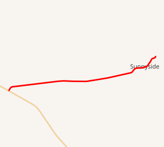
Utah State Route 123 (SR-123) is a state highway in the U.S. state of Utah. Spanning 11.4 miles (18.3 km), it connects the city of East Carbon with US-6 / US-191 in Carbon County.
| ||||
|---|---|---|---|---|

SR-123 highlighted in red | ||||
| Route information | ||||
| Defined by Utah Code §72-4-118 | ||||
| Maintained by UDOT | ||||
| Length | 11.421 mi[1] (18.380 km) | |||
| Existed | 1931[2] (as SR-124, renumbered in 1933)–present | |||
| Major junctions | ||||
| West end | ||||
| East end | Eastern East Carbon | |||
| Highway system | ||||
| ||||
Route description
State Route 123 begins at Sunnyside Junction on US-6/US-191, about 15 miles (24 km) southeast of Price.[3] It heads east, passing through East Carbon-Sunnyside at the base of the Book Cliffs. It turns to the northeast and terminates shortly after it enters Whitmore Canyon.[3]
History
The road from Sunnyside Junction through Sunnyside to Columbia (now all part of East Carbon-Sunnyside) was added to the state highway system in 1931, initially numbered SR-124[4] but changed to SR-123 in 1933.[5] The route was shortened in 1935 by moving the eastern terminus back into Sunnyside,[6] and splitting off the portion from Sunnyside to Columbia as SR-124.[7]
Major intersections
The entire route is in Carbon County.
| Location | mi[1] | km | Destinations | Notes | |
|---|---|---|---|---|---|
| Sunnyside Junction | 0.000 | 0.000 | Western terminus | ||
| East Carbon | 8.694 | 13.992 | |||
| 11.421 | 18.380 | "End State Maintenance" sign — Whitemore Canyon Road | Eastern terminus | ||
| 1.000 mi = 1.609 km; 1.000 km = 0.621 mi | |||||
References
- "Utah State Route 123 Reference" (pdf). Utah Department of Transportation. 1 May 2008. Retrieved 12 April 2011.
- "Utah State Route 123 Resolutions" (pdf). Utah Department of Transportation. November 2008. Retrieved 12 April 2011.
- Google (12 April 2011). "Utah State Route 123" (Map). Google Maps. Google. Retrieved 12 April 2011.
- Utah State Legislature (1931). "Chapter 55: Designation of State Roads". Session Laws of Utah.
(124) From Sunnyside junction easterly via Sunnyside to Columbia.
- Utah State Legislature (1933). "Chapter 30". Session Laws of Utah.
(123) From Sunnyside Junction easterly via Sunnyside to Columbia.
- Utah State Legislature (1935). "Chapter 37: Designation of State Roads". Session Laws of Utah.
Route 123. From Sunnyside Junction on route 8 easterly to Sunnyside.
- Utah State Legislature (1935). "Chapter 37: Designation of State Roads". Session Laws of Utah.
Route 124. From junction with route 123 southerly to Columbia.
