Uamh Bheag
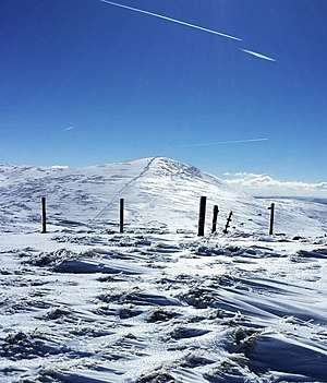
Uamh Bheag is a hill in the Glen Artney Hills range immediately south of the Highland Boundary Fault, part of the Central Lowlands of Scotland. The highest hill of the range, the summit is twin-topped; the lower east top has a trig point. Until 2017, it was not certain which hill was higher, and subsequently which was the Donald and Graham. That year, a survey was conducted which proved the west top to be approximately 2.4m higher.[1] The true summit is currently marked with a cairn and a face carved out of a wooden fencepost, extending from it. It is normally ascended with neighbouring Beinn nan Eun from Glen Artney itself.[2]
| Uamh Bheag | |
|---|---|
 | |
| Highest point | |
| Elevation | 665.8 m (2,184 ft) [1] |
| Prominence | 325 m (1,066 ft) [2] |
| Listing | Ma,Hu,Tu,Sim,G,D,DN,Y [3] |
| Naming | |
| English translation | 'Little Cave' |
| Geography | |
| Location | Stirlingshire, Perth and Kinross, Scotland |
| Parent range | Glen Artney Hills, Southern Uplands |
| OS grid | NN 69118 11846 |
| Topo map | OS Landranger 57 |
Subsidiary SMC Summits
| Summit | Height (m) | Listing[3] |
|---|---|---|
| Meall Clachach | 618.8 | DT,sSim[4] |
gollark: Or it randomly starts using all my CPU to compile some sort of C module.
gollark: Or "this version is deprecated, please switch to the new one immediately".
gollark: If I leave a project untouched for a few months, and check on stuff, often I get a warning like "5 severe security vulnerabilities, please update now".
gollark: I use Node.js sometimes, and it has its own !!FUN!! stuff going on like that, actually.
gollark: Apparently you can probably use "virtualenvs" or something, but I don't know how that works.
References
- https://www.hill-bagging.co.uk/surveys/Surveys%20of%20Uamh%20Bheag%20and%20Uamh%20Bheag%20East%20Top.pdf
- "Uamh Bheag". www.hill-bagging.co.uk.
- "Database of British and Irish Hills: user guide". www.hills-database.co.uk.
- "Meall Clachach". www.hill-bagging.co.uk.
This article is issued from Wikipedia. The text is licensed under Creative Commons - Attribution - Sharealike. Additional terms may apply for the media files.