U.S. Route 27 in Ohio
U.S. Route 27 (US 27) in Ohio runs for 40.6 miles (65.3 km) between the Kentucky and Indiana state lines: 18.5 miles (29.8 km) in Hamilton County and another 22.1 miles (35.6 km) in Butler County. The route crosses into Ohio and Downtown Cincinnati via the Taylor–Southgate Bridge over the Ohio River. US 27 follows Mehring Way, Central Avenue, Ezzard Charles Drive and Central Parkway through Downtown Cincinnati. US 27 briefly duplexes with I-75, exiting at I-74 for another brief duplex before exiting onto Colerain Road. US 27 then continues northwest eventually to Oxford, and then reaches the Indiana border another six miles (9.7 km)northwest at College Corner.
| ||||
|---|---|---|---|---|
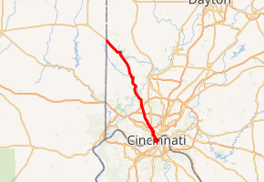
US 27 in red, US 27 directional alternate in blue | ||||
| Route information | ||||
| Maintained by ODOT | ||||
| Length | 40.58 mi[1] (65.31 km) | |||
| Major junctions | ||||
| South end | ||||
| North end | ||||
| Location | ||||
| Counties | Hamilton, Butler | |||
| Highway system | ||||
| ||||

Route description
US 27 enters Ohio on the Taylor–Southgate Bridge, over the Ohio River, as a four-lane highway. After the bridge ends, the highway passes between the U.S. Bank Arena and a parking structure. US 27 has a traffic signal with East Pete Rose Way and Broadway. The route turns west onto East Pete Rose Way, before turning southeast onto Mehring Way, concurrent with US 52. Mehring Way curves towards the west and passes under the Taylor–Southgate Bridge. After the bridge the street parallels the Ohio River on the south side of the road and the U.S. Bank Arena to the north. After the arena the road parallels the Great American Ballpark, on the north side of the road. While passing the ballpark on the north side, the south side of the road passes the Cincinnati Riverfront Park. The street passes under the Roebling Bridge, before passes to the south of Paul Brown Stadium. On the southwest corner of the stadium US 27 and US 52 turns north onto Central Avenue. Central Avenue passes on the west side of the stadium, before having a final traffic signal with Pete Rose Way. The route continues north passing the west side of the romanesque Cincinnati City Hall. The route wanders between I-75 and I-74 before leaving the latter at elevation 490 feet and ascending through Mount Airy forest in 2 miles to 930 ft at the Cincinnati Water Tanks on North Bend Road. The stretch from here to Strubble Road is a quite busy multilane highway. After the intersection at Strubble one passes Mount Rumpke(dump) on the right and the divided rural road crosses the Great Miami River at elevation 525 feet. The road between Strubble and Oxford was called the highway to heaven by 1986. There were at times at least 80 crosses along the highway. After this publicity the road was widened, curves were straightened, and the speed limit was lowered to 45 mph. A herringbone brick intersection of Chestnut Street and Patterson Avenue is at the southeast corner of Oxford at U.S. 27. The highway northwest of Oxford is straight and rural being improved 10-15 years ago. This final section passes to the west of the Oxford Walmart and within a mile of the Butler co. highpoint before reaching College Corner. [2]
Major intersections
| County | Location | mi[1] | km | Destinations | Notes |
|---|---|---|---|---|---|
| Ohio River | 0.00 | 0.00 | Continuation into Kentucky | ||
| Taylor–Southgate Bridge | |||||
| Hamilton | Cincinnati | 0.23 | 0.37 | Eastern end of SR 52 concurrency | |
| 1.42 | 2.29 | Southern end of US 42/US 172 concurrency | |||
| 1.60 | 2.57 | Western terminus of US 42; southern terminus of SR 3; eastern terminus of SR 264 eastbound | |||
| 1.69 | 2.72 | Westbound SR 264 | |||
| 1.77 | 2.85 | ||||
| 4.76 | 7.66 | ||||
| 4.86 | 7.82 | Northern end of US 127 concurrency | |||
| 4.94 | 7.95 | Northbound US 27/US 52 to I–75 only; southern end of I–75 concurrency | |||
| 5.52 | 8.88 | Northern end of I–75 concurrency; southern end of I–74 concurrency; southern terminus of I–74 | |||
| 6.03 | 9.70 | Northern end of I–74/US 52 concurrency | |||
| 6.84– 6.90 | 11.01– 11.10 | ||||
| | 11.69– 11.87 | 18.81– 19.10 | Southern end of SR 126 concurrency | ||
| | 14.08 | 22.66 | |||
| Butler | | 19.12– 19.32 | 30.77– 31.09 | Interchange. Northern end of SR 126 concurrency | |
| Millville | 24.44 | 39.33 | Southern end of SR 129 concurrency | ||
| 24.73 | 39.80 | Northern end of SR 129 concurrency | |||
| | 29.00 | 46.67 | Western terminus of SR 130 | ||
| Oxford | 34.09 | 54.86 | Southern end of SR 73 concurrency | ||
| 34.90 | 56.17 | Northern end of SR 73 concurrency; western terminus of SR 73 | |||
| College Corner | 40.58 | 65.31 | Continuation into Indiana | ||
1.000 mi = 1.609 km; 1.000 km = 0.621 mi
| |||||
References
- Ohio Department of Transportation. "Technical Services Straight Line Diagrams". Retrieved September 21, 2013.
- Google (May 24, 2019). "Overview Map of U.S. Route 27 in Ohio" (Map). Google Maps. Google. Retrieved May 24, 2019.
External links

| Previous state: Kentucky |
Ohio | Next state: Indiana |