Macouria
Macouria is a commune of French Guiana located midway between Cayenne and Kourou, an overseas region and department of France located in South America. The seat of the commune is the settlement of Tonate, and so the commune is also known unofficially as Macouria-Tonate.[2]
Macouria | |
|---|---|
View of the Church of Saint-Jean-Baptiste of Tonate, along the RN1 road | |
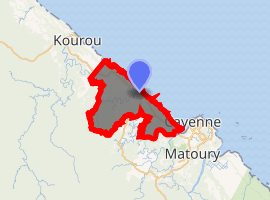
Location of the commune (in red) within French Guiana | |
Location of Macouria 
| |
| Coordinates: 5°00′50″N 52°28′27″W | |
| Country | France |
| Overseas region and department | French Guiana |
| Arrondissement | Cayenne |
| Intercommunality | Centre Littoral |
| Government | |
| • Mayor (2014-2020) | Gilles Adelson |
| Area 1 | 377.5 km2 (145.8 sq mi) |
| Population (2017-01-01)[1] | 14,202 |
| • Density | 38/km2 (97/sq mi) |
| Time zone | UTC−03:00 |
| INSEE/Postal code | 97305 /97355 |
| Elevation | 0–183 m (0–600 ft) |
| 1 French Land Register data, which excludes lakes, ponds, glaciers > 1 km2 (0.386 sq mi or 247 acres) and river estuaries. | |
Geography
Macouria is one of the smallest cities of French Guiana. The city is separated in the east with Matoury, by the Larivot Bridge, crossing the Cayenne River. Its southern limit is marked by the Montsinéry River, which is a separation with the eponymous city. Westward there is Kourou and in the north the city is the Atlantic Ocean.
Urbanization
The population is mainly located south and along the national road RN1 because of 2 km wide mangrove swamp situated in the North.
- From the Larivot bridge to the city center, on approximately 28 km, there are many villages.
- From the city center to Kourou, there are few inhabitants except in the farming areas of "La Césarée" and "Matiti".
The main inhabited zones are:
- Maillard : a neighborhood which will host 600 houses on the long run organized around the blue lake, which is a former quarry.
- Soula : located in the East of the city not far away from Cayenne.
- Matiti: situated 10 km after the city center, it is based on land given back by the space center.
History
The area was first described in 1604 by Daniel de La Touche de La Ravardière. He counted many Amerindian settlements.[3] Around 1716, the commune was settled with plantations. Tonat build the first house and cotton mill.[4]
In the middle of the 19th century, Macouria was part of the canton of Cayenne. 1488 slaves stood for 93% of the population of the "neighborhood" led by Jean-Baptiste Tonat. They worked in a plantation called "La Béarnaise". On it, there were :
- 25 ha of sugar cane
- 8 ha of cofe
- 60 ha of roucou
- 1100 ha of cotton
In tribute to the leader of the neighborhood Tonat, the zone was called "Tonate Bourg" and given to the state.
In 1848, year of the abolition of slavery some free Africans and 55 Indian migrants arrived in the city. From 1864 to 1970 the population decreased, mainly because of the lack of activity on it.
See also
References
- "Populations légales 2017". INSEE. Retrieved 6 January 2020.
- "MACOURIA TONATE". Le CodePostal (in French). Retrieved 9 June 2020.
- "Histoire de Macouria". Macouria.fr (in French). Retrieved 9 June 2020.
- "Guide Macouria". Petit Futé (in French). Retrieved 9 June 2020.