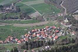
Tomils
Tomils is a former municipality in the district of Hinterrhein in the Swiss canton of Graubünden. It was formed on 1 January 2009 through the merger of Feldis/Veulden, Scheid, Trans and Tumegl/Tomils. On 1 January 2015 the former municipalities of Almens, Paspels, Pratval, Rodels and Tomils merged to form the new municipality of Domleschg.[1]
Tomils | |
|---|---|
 | |
 Coat of arms | |
Location of Tomils 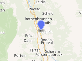
| |
 Tomils Tomils | |
| Coordinates: 46°45′N 9°26′E | |
| Country | Switzerland |
| Canton | Graubünden |
| District | Hinterrhein |
| Area | |
| • Total | 30.56 km2 (11.80 sq mi) |
| Elevation | 801 m (2,628 ft) |
| Population (Dec 2013) | |
| • Total | 717 |
| • Density | 23/km2 (61/sq mi) |
| Postal code | 7418 |
| SFOS number | 3671 |
| Website | www SFSO statistics |
Demographics
Tomils had a population (as of 2013) of 717.[2]
Dreibündenstein
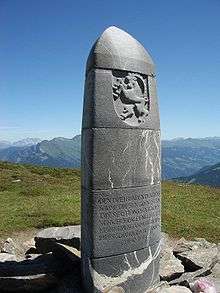
The Dreibündenstein (|Romanish: Term bel) is a marker erected at the intersection of the Three Leagues (League of God's House, the League of the Ten Jurisdictions and the Grey League) which would found the modern canton of Graubünden. The stone is at an elevation of 2,160 m (7,090 ft) above sea level, on the border between the municipalities of Domat/Ems, Scheid village (now part of Tomils municipality), and Malix.
The original stone dates from 1722, and today is in the Rätian Museum in Chur. In 1742, Nicolin Sererhard mentions three stones. The Sektion Rhätia (Rhätian Section) of the Swiss Alpine club built this two-metre (6 ft 7 in) stone marker 105 years ago in 1915. A chairlift was added to mountain in 1970, improving access to the marker.[3]
References
- Amtliches Gemeindeverzeichnis der Schweiz published by the Swiss Federal Statistical Office (in German) accessed 2 January 2013
- Swiss Federal Statistical Office accessed 16 January 2015
- Dreibündenstein in German, French and Italian in the online Historical Dictionary of Switzerland.