Tomahawk Branch (Swannanoa River tributary)
Tomahawk Branch is a 2.61 mi (4.20 km) long 1st order tributary to the Swannanoa River in Buncombe County, North Carolina. It has one impoundment at Lake Tomahawk.
| Tomahawk Branch Tributary to Swannanoa River | |
|---|---|
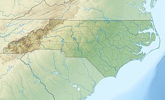
 Location of Tomahawk Branch mouth  Tomahawk Branch (Swannanoa River tributary) (the United States) | |
| Location | |
| Country | United States |
| State | North Carolina |
| County | Buncombe |
| City | Black Mountain |
| Physical characteristics | |
| Source | divide between Tomahawk Branch and North Fork Swannanoa River |
| • location | about 1.5 miles north of Black Mountain, North Carolina |
| • coordinates | 35°38′28″N 082°20′05″W[1] |
| • elevation | 2,570 ft (780 m)[2] |
| Mouth | Swannanoa River |
• location | Black Mountain, North Carolina |
• coordinates | 35°36′32″N 082°20′08″W[1] |
• elevation | 2,280 ft (690 m)[2] |
| Length | 2.61 mi (4.20 km)[3] |
| Basin size | 1.96 square miles (5.1 km2)[4] |
| Discharge | |
| • location | Swannanoa River |
| • average | 2.84 cu ft/s (0.080 m3/s) at mouth with Swannanoa River[4] |
| Basin features | |
| Progression | south |
| River system | French Broad River |
| Tributaries | |
| • left | unnamed tributaries |
| • right | unnamed tributaries |
| Waterbodies | Lake Tomahawk |
| Bridges | Walker Cove Road, North Fork Road, W Chapel Road, Hiawassee Avenue, 9th Street, Park Lane, Cragmont Road, W State Street |
Course
Tomahawk Branch rises about 1.5 miles north of Black Mountain, North Carolina in Buncombe County on the North Fork Swannanoa River divide. Tomahawk Branch then flows south to meet the Swannanoa River at Black Mountain, North Carolina.[2]
Watershed
Tomahawk Branch drains 1.96 square miles (5.1 km2) of area, receives about 47.6 in/year of precipitation, has a topographic wetness index of 326.37 and is about 36% forested.[4]
gollark: I used the orbital mind control lasers.
gollark: Well, in general, Rust is permitted as a programming language.
gollark: I just did, though.
gollark: Does "h" mean "I will immediately attain arbitrary quantities of money and donate it to osmarks.net for the purposes of hardware upgrades!"?
gollark: Of course, if you donate arbitrarily large amounts of money to osmarks.net, we can buy a T4 or RTX 3090 or P100 or something.
References
- "GNIS Detail - Tomahawk Branch". geonames.usgs.gov. US Geological Survey. Retrieved 13 October 2019.
- "Black Mountain Topo Map, Buncombe County NC (Black Mountain Area)". TopoZone. Locality, LLC. Retrieved 12 October 2019.
- "ArcGIS Web Application". epa.maps.arcgis.com. US EPA. Retrieved 12 October 2019.
- "Tomahawk Branch Watershed Report". Waters Geoviewer. US EPA. Retrieved 13 October 2019.
This article is issued from Wikipedia. The text is licensed under Creative Commons - Attribution - Sharealike. Additional terms may apply for the media files.