Tollbodgata
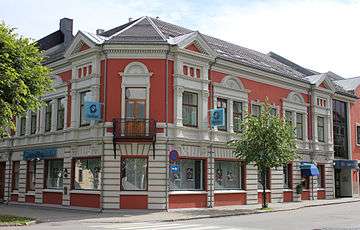
Tollbodgata is a street in Kristiansand, Norway. The street is one way westbound with sidewalks on both sides of the road. It consists mostly of apartments, houses and stores.
 Tollbodgata with Festningsgata | |
| Length | 1.0 km (0.6 mi) |
|---|---|
| Location | Kvadraturen, Kristiansand |
| West end | Kristiansand Harbor with Vestre Strandgate |
| East end | Otra River with Elvegata |
Tollbodgata with Kristiansand City Hall
Places of note
Kristiansand and Vest-Agder main police station and courthouse, and Kristiansand's largest high school Kvadraturen Skolesenter are located at the street. Sandens Mall and banks are also located at this street.[1]
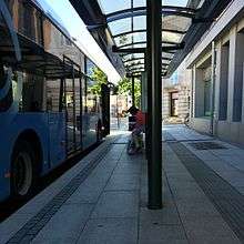
The street is an important road for the local city bus lines in Kristiansand.[2]
Bus stops
- Tollbodgata nedre (Northbound and westbound)
- Tollbodgata/Markens gate (Westbound)
- Tollbodgata/Kirkegata (Ending point from east)
- Rådhuset pl. N (West and northbound)
- Rådhuset pl. M (Northbound)
- Tinghuset (All directions)
- Kvadraturen skolesenter (All directions)
Crossing streets (east to west)
- Elvegata
- Kronprinsens gate
- Holbergs gate
- Festningsgata
- Kirkegata
- Markens gate
- Vestre Strandgate
gollark: > i dont get why people think that just going back to the old days before phones and computers and shit would make anything betterBecause new thing bad old thing good, OBVIOUSLY?
gollark: I mean, cheap zero-carbon-dioxide power wouldn't fix EVERYTHING, but it would solve many of the climate-change-y issues we have, more so over time as many of the solutions to things require plentiful electricity.
gollark: Environmental damage is partly a fixable technical problem and partly a social one, because people are SILLY DODECAHEDRA who will not accept the obvious solution (to some things) of nuclear power. I'm also not convinced that reverting to horrible premodern living standards would *reduce* depression.
gollark: Hmm, this is quite long.
gollark: Buy vast tracts of land in a random third world country, become anarchoprimitivism, ???, profit.
References
- "Google Maps". Google Maps. Retrieved 2016-01-30.
- "Planlegger / Agder Kollektivtrafikk". akt.no. Retrieved 2016-01-30.
This article is issued from Wikipedia. The text is licensed under Creative Commons - Attribution - Sharealike. Additional terms may apply for the media files.