Thoulcanna County
Thoulcanna County is one of the 141 Cadastral divisions of New South Wales. It is located south of the border with Queensland, to the west of the Paroo River near Wanaaring in the Bourke Shire.
| Thoulcanna New South Wales | |||||||||||||||
|---|---|---|---|---|---|---|---|---|---|---|---|---|---|---|---|
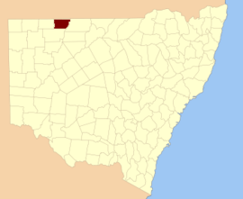 Location in New South Wales | |||||||||||||||
| |||||||||||||||
The name Thoulcanna is believed to be derived from a local Aboriginal word and is also the name of the local Thoulcanna Station.[1]
Parishes within this county
A full list of parishes found within this county; their current LGA and mapping coordinates to the approximate centre of each location is as follows:
| Parish | LGA | Coordinates |
|---|---|---|
| Clear Water | Unincorporated | 29°22′42″S 144°17′32″E |
| Colaine | Unincorporated | 29°33′01″S 143°42′38″E |
| Currabenya | Unincorporated | 29°06′35″S 143°44′49″E |
| Davis | Unincorporated | 29°10′21″S 143°58′15″E |
| Davison | Unincorporated | 29°22′43″S 143°41′57″E |
| Eurimbula | Unincorporated | |
| Evelyn | Unincorporated | 29°20′43″S 144°22′20″E |
| Feehan | Unincorporated | 29°13′54″S 144°04′46″E |
| Flood | Unincorporated | 29°15′19″S 143°42′09″E |
| Kelly | Unincorporated | 29°13′36″S 144°24′33″E |
| Kerrininna | Unincorporated | 29°10′07″S 144°23′25″E |
| Nardoo | Unincorporated | 29°31′56″S 144°08′49″E |
| Newland | Unincorporated | 29°09′44″S 144°11′12″E |
| Odonnell | Unincorporated | 29°13′46″S 144°15′27″E |
| Stony Ridge | Unincorporated | 29°28′59″S 144°17′56″E |
| Talyeale | Unincorporated | 29°01′21″S 144°07′50″E |
| Waverley | Unincorporated | 29°06′01″S 143°58′16″E |
| Willera | Unincorporated | 29°26′38″S 143°53′50″E |
| Yernca | Bourke Shire | 29°34′09″S 144°23′49″E |
gollark: C++ with words!
gollark: Esolang idea: A thing like Unary, but where the unary encoding is replaced with an English number.
gollark: What about Mars? Everyone knows it's a star.
gollark: The stars are unaligned.
gollark: C = 🌵
References
- "Thoulcanna". Geographical Names Register (GNR) of NSW. Geographical Names Board of New South Wales. Retrieved 4 August 2013.

This article is issued from Wikipedia. The text is licensed under Creative Commons - Attribution - Sharealike. Additional terms may apply for the media files.