Aberdeen, Eastern Cape
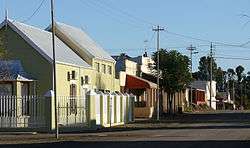
Aberdeen is a small town in the Sarah Baartman District Municipality of the Eastern Cape province of South Africa. With its numerous examples of Victorian architecture, it is one of the architectural conservation areas of the Karoo.
Aberdeen | |
|---|---|
 Street in Aberdeen | |
 Aberdeen  Aberdeen | |
| Coordinates: 32°29′S 24°4′E | |
| Country | South Africa |
| Province | Eastern Cape |
| District | Sarah Baartman |
| Municipality | Dr Beyers Naudé |
| Established | 1856[1] |
| Area | |
| • Total | 15.4 km2 (5.9 sq mi) |
| Population (2011)[2] | |
| • Total | 7,162 |
| • Density | 470/km2 (1,200/sq mi) |
| Racial makeup (2011) | |
| • Black African | 19.4% |
| • Coloured | 73.0% |
| • Indian/Asian | 0.4% |
| • White | 6.7% |
| • Other | 0.4% |
| First languages (2011) | |
| • Afrikaans | 80.7% |
| • Xhosa | 15.5% |
| • English | 2.2% |
| • Other | 1.6% |
| Time zone | UTC+2 (SAST) |
| Postal code (street) | 6270 |
| PO box | 6270 |
| Area code | 049 |
Town some 55 km south-west of Graaff-Reinet, 155 km east-south-east of Beaufort West, 32 km south of the Camdeboo Mountains. Laid out on the farm Brakkefontein as a settlement of the Dutch Reformed Church in 1856, it became a municipality in 1858. It is named after Aberdeen in Scotland, birthplace of the Reverend Andrew Murray of Graaff-Reinet, relieving minister.[3]
The Aberdeen Provincial Hospital is situated in Aberdeen.
Famous People from Aberdeen
gollark: Or free legal internet resources if you like I guess.
gollark: Yes, piracy is the way forward.
gollark: I probably want to do physics/engineering or something like that.
gollark: There are many vaguely interesting fields, but I have no idea if there's any one thing I care about enough to specialise in for several years.
gollark: Yes, I worry about that too.
References
- "Chronological order of town establishment in South Africa based on Floyd (1960:20-26)" (PDF). pp. xlv–lii.
- Sum of the Main Places Aberdeen and Thembalesizwe from Census 2011.
- Raper, Peter E. (1987). Dictionary of Southern African Place Names. Internet Archive. p. 51. Retrieved 28 August 2013.
External links
- Eastern Cape Tourism Board

This article is issued from Wikipedia. The text is licensed under Creative Commons - Attribution - Sharealike. Additional terms may apply for the media files.
.svg.png)