The Rye (brook)
The Rye is a stream rising east of Ashtead and flowing into the River Mole near Leatherhead, Surrey.[1]
| The Rye | |
|---|---|
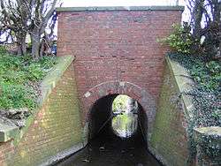 The Rye at Gutters Bridge, Leatherhead | |
| Location | |
| Country | England |
| Region | South East |
| District | Mole Valley District |
| City | Leatherhead |
| Physical characteristics | |
| Source | Ashtead Common |
| Mouth | River Mole |
• location | Leatherhead |
The Rye Brook flows westwards across Ashtead Common, through the Ashtead Common National Nature Reserve, managed by the City of London Corporation. For much of its course the brook follows a straight channelled course which was dug during the Second World War in order to drain the surrounding land so that it could be used for agriculture. Under a recent (2005) initiative by the City of London Corporation, parts of the course have been remodelled. The remodelling includes meandering and reprofiling the riverbed, banks and adjacent land to create a more natural setting, in order to create a wetland habitat that will encourage a diverse wildlife.
References
- Jackson, Alan A. (1977). Ashtead, a village transformed : a history of Ashtead from the earliest times to the present day. Leatherhead: Leatherhead & District Local History Society.