The Hill, New Haven
The Hill is the southwestern-most neighborhood of New Haven, Connecticut.[1] As early as 1800, this area was known as "Sodom Hill".[2] Located directly south of Downtown New Haven, the neighborhood is now home to New Haven Union Station as well as Yale-New Haven Hospital and the Yale School of Medicine.
The Hill | |
|---|---|
Neighborhood of New Haven | |
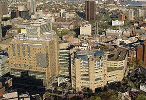 Yale-New Haven Hospital | |
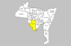 location of The Hill within New Haven | |
| Coordinates: 41°17′46″N 72°56′13″W | |
| Country | United States |
| State | Connecticut |
| City | New Haven |
History
Originally a distinct suburb of New Haven, The Hill began its urban development in the early 1800s. The sub-neighborhood south of Columbus Ave now known as Trowbridge Square was established in the 1830s by brothers Nathaniel and Simeon Jocelyn. Known at first as the village of Spireworth, this enclave was founded as a rare example of a racially integrated planned community.[3]
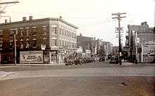
In the middle of the century waves of Irish and German immigrants began pouring into the neighborhood. African-Americans migrated from the American South, and this neighborhood also served as a stop on the Underground Railroad.[3]
In 1957 a sizable swath of the Hill containing 881 households and 350 businesses was flattened to make way for the Oak Street Connector, a 1.1 mile highway stub that was never extended toward Derby as originally planned.[4] In 2013 New Haven began work to downgrade the Oak Street Connector into city streets in an effort to reconnect The Hill to Downtown New Haven.
Geography
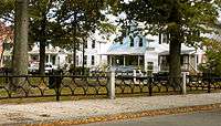
The Hill is bounded by the Route 34/Oak Street Connector and Legion Ave. at the north, the Long Wharf neighborhood at the east, the city of West Haven at the west, and Long Island Sound at the south.[5] The southeastern part of the neighborhood (south of Columbus Avenue) is roughly divided into three sections: Kimberly Square, Trowbridge Square, and City Point. This area south of Columbus Avenue originally was known as the Oyster Point Quarter, while the area north of Columbus Avenue was known as Sodom Hill. The Trowbridge Square section and the southern half of the City Point section are listed as historic districts on the National Register of Historic Places. City Point, which is located south of the railroad tracks, was traditionally a separate neighborhood but official neighborhood planning maps now include it in The Hill. The block formed by Redfield, West, Congress, and Columbus is also a state historic district known as Redfield & West Streets Historic District.
Columbus Avenue, Washington Avenue, and Howard Avenue are the three main arteries of the Hill. Between Washington Avenue and I-95, the area immediately fronting Howard Avenue has been designated as a historic district, the Howard Avenue Historic District.
Economy
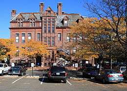
The Hill neighborhood contains the majority of buildings of Yale-New Haven Hospital and Yale Medical School. The expansion of this Medical campus area is a continual source of tension with the bordering residential areas. The residential areas of the Hill are mostly working-class and minority neighborhoods; crime and poverty remain problems, though to a far lesser degree.
The Hill is also home to New Haven's railroad station, Union Station, and some light-industrial businesses such as the Lupi-Legna Bakery. Public schools and libraries include; Roberto Clemente Leadership Academy and the Wilson Library.
Demographics
The ZIP code for the neighborhood is 06519.[5] As of 2010, the population of this ZIP code was 16,428 with an ethnic makeup of 50.5% Hispanic or Latino, 9.8% non-Hispanic white, 36.9% non-Hispanic African American, 0.7% Native American, 1.2% Asian, 0.1% Pacific Islander, 0.1% non-Hispanic from some other race and 3.6% from two or more races.[6]
References
- Hill (PDF) (Map). New Haven City Plan Department. Retrieved 2009-02-06.
- E. M. Brown, New Haven: A guide to architecture and urban design, Yale University Press, 1976.
- "Old as 'The Hill:' New Haven neighborhood's history on display at museum (video)".
- Gibbons, Lauren. "The Yale Herald".
- Hello New Haven
- 2010 census report for 06519 zip code