Texas State Highway 176
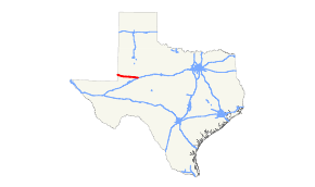
State Highway 176 (SH 176) is a Texas state highway running from the New Mexico state line east to Big Spring. It is most commonly known as the Andrews Highway.[2]
| ||||
|---|---|---|---|---|
| Andrews Highway | ||||
 | ||||
| Route information | ||||
| Maintained by TxDOT | ||||
| Length | 90.00 mi[1] (144.84 km) | |||
| Existed | 1953 (1990)–present | |||
| Major junctions | ||||
| West end | ||||
| East end | ||||
| Location | ||||
| Counties | Andrews, Martin, Howard | |||
| Highway system | ||||
| ||||

History
SH 176 was originally designated on September 22, 1932 as a connector route between Tyler and the Gregg/Rusk County Line.[3] On May 23, 1933, SH 176 was extended to Kilgore.[4] On September 26, 1939, this route had been reassigned to SH 31 when its path was shifted south.
The current routing was first cosigned, but not designated, on September 29, 1953 concurrent with FM 87. On August 29, 1990 this route was officially designated, canceling FM 87.[5]
Major intersections
| County | Location | mi[6] | km | Destinations[6] | Notes |
|---|---|---|---|---|---|
| Andrews | | 0.00 | 0.00 | Continuation into New Mexico | |
| Andrews | 30.40 | 48.92 | Western terminus of concurrency with SH 115 | ||
| 31.50 | 50.69 | ||||
| | 33.90 | 54.56 | Eastern terminus of concurrency with SH 115 | ||
| Martin | Tarzan | 53.60 | 86.26 | Diamond interchange | |
| Lenorah | 74.60 | 120.06 | |||
| Howard | Big Spring | 93.00 | 149.67 | Exit 176 on I-20 | |
1.000 mi = 1.609 km; 1.000 km = 0.621 mi
| |||||
gollark: Oh, and for the achievements system and (obviously) interactive projects.
gollark: My website is designed as *mostly* static, but has some JS for comments and such.
gollark: I mean, browsers are a surprisingly good app platform.
gollark: I feel like much of the time it's horribly misused and applications have way too much for no apparent reason, but sometimes it's nice!
gollark: Mine probably should, but does not yet, include a "locally saved draft" feature when editing pages.
References
- Transportation Planning and Programming Division (n.d.). "State Highway No. 176". Highway Designation Files. Texas Department of Transportation.
- "TxDOT plans road work in Andrews County". Oaoa.com. February 1, 2017.
- (PDF) https://publicdocs.txdot.gov/minord/MinuteOrderDocLib/003673819.pdf. Missing or empty
|title=(help) - (PDF) https://publicdocs.txdot.gov/minord/MinuteOrderDocLib/003673828.pdf. Missing or empty
|title=(help) - (PDF) https://publicdocs.txdot.gov/minord/MinuteOrderDocLib/003687187.pdf. Missing or empty
|title=(help) - Google (January 21, 2016). "Texas State Highway 176" (Map). Google Maps. Google. Retrieved January 21, 2016.
This article is issued from Wikipedia. The text is licensed under Creative Commons - Attribution - Sharealike. Additional terms may apply for the media files.