Tetuán, Utuado, Puerto Rico
Tetuán is a barrio in the municipality of Utuado, Puerto Rico. Its population in 2010 was 680.[3][4][5]
Tetuán | |
|---|---|
Barrio | |
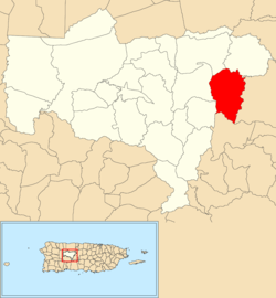 Location of Tetuán within the municipality of Utuado shown in red | |
 Tetuán Location of Puerto Rico | |
| Coordinates: 18°16′04″N 66°36′45″W[1] | |
| Commonwealth | |
| Municipality | |
| Area | |
| • Total | 5.46 sq mi (14.1 km2) |
| • Land | 5.46 sq mi (14.1 km2) |
| • Water | 0 sq mi (0 km2) |
| Elevation | 2,096 ft (639 m) |
| Population (2010) | |
| • Total | 680 |
| • Density | 124.5/sq mi (48.1/km2) |
| Source: 2010 Census | |
| Time zone | UTC−4 (AST) |
History
The United States took control of Puerto Rico from Spain in the aftermath of the Spanish-American War under the terms of the Treaty of Paris of 1898. In 1899, the United States conducted its first census of Puerto Rico finding that the population of Tetuán barrio was 1,678.[6]
Landslide
On May 28, 2019 a landslide occurred in Tetuán cutting off many families' access to the main road, Puerto Rico Highway 140. The mayor said landslides are a normal occurrence in the Utuado municipality.[7]
gollark: There are political axes and compasses and hypercubes and such, and while none (well, except ridiculous ones) can actually capture your political views entirely accurately, some are *useful*.
gollark: China didn't exactly *help* things by covering it up initially, but America was/is definitely not doing great either.
gollark: The UK is at least taking it somewhat seriously, if not actually handling it that well.
gollark: North Korea is probably just doing a combination of not testing, reporting no accurate data whatsoever, and killing anyone with bad symptoms.
gollark: If you have drew a line-art version of this it would probably be possible to write a script to convert it to equations automatically.
See also
References
- "US Gazetteer 2019". US Census. US Government.
- U.S. Geological Survey Geographic Names Information System: Tetuán barrio
- Picó, Rafael; Buitrago de Santiago, Zayda; Berrios, Hector H. Nueva geografía de Puerto Rico: física, económica, y social, por Rafael Picó. Con la colaboración de Zayda Buitrago de Santiago y Héctor H. Berrios. San Juan Editorial Universitaria, Universidad de Puerto Rico,1969.
- Gwillim Law (20 May 2015). Administrative Subdivisions of Countries: A Comprehensive World Reference, 1900 through 1998. McFarland. p. 300. ISBN 978-1-4766-0447-3. Retrieved 25 December 2018.
- Puerto Rico:2010:population and housing unit counts.pdf (PDF). U.S. Dept. of Commerce, Economics and Statistics Administration, U.S. Census Bureau. 2010.
- Joseph Prentiss Sanger; Henry Gannett; Walter Francis Willcox (1900). Informe sobre el censo de Puerto Rico, 1899, United States. War Dept. Porto Rico Census Office (in Spanish). Imprenta del gobierno. p. 161.
- Claudio, Ronald Ávila. "Abierto el paso en carretera de Utuado luego de derrumbe". Metro.
This article is issued from Wikipedia. The text is licensed under Creative Commons - Attribution - Sharealike. Additional terms may apply for the media files.