Telerig Nunatak
Telerig Nunatak (Nunatak Telerig \'nu-na-tak te-le-'rig\) is a rocky peak of elevation 170 m projecting from the ice cap of Greenwich Island in the South Shetland Islands, Antarctica in the southwest extremity of Dryanovo Heights.
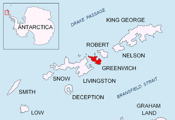
Location of Greenwich Island in the South Shetland Islands.
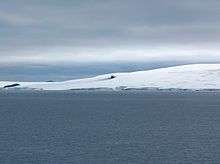
Telerig Nunatak from Half Moon Island.

Topographic map of Livingston Island, Greenwich, Robert, Snow and Smith Islands.
The feature is named after the Bulgarian ruler Khan Telerig, 768-777 AD.
Location
The nunatak is located at 62°29′35″S 59°55′33″W which is 2.07 km northwest of Yovkov Point, 1.9 km west-southwest of Lloyd Hill, 1.67 km south-southeast of Panagyurishte Nunatak and 1.6 km east-southeast of Kerseblept Nunatak (Bulgarian topographic survey Tangra 2004/05 and mapping in 2009).
Maps
- L.L. Ivanov et al. Antarctica: Livingston Island and Greenwich Island, South Shetland Islands. Scale 1:100000 topographic map. Sofia: Antarctic Place-names Commission of Bulgaria, 2005.
- L.L. Ivanov. Antarctica: Livingston Island and Greenwich, Robert, Snow and Smith Islands. Scale 1:120000 topographic map. Troyan: Manfred Wörner Foundation, 2009. ISBN 978-954-92032-6-4
gollark: I do, however, have 'The Sea Floor - An Introduction to Marine Geology.epub'.
gollark: I don't have it.
gollark: pls gib RE folder
gollark: Hmm. Clearly I will have to store them archived and backwards to prevent any accidents.
gollark: If they're Windows trojans, it's fiiiiiiine.
References
- Telerig Nunatak. SCAR Composite Antarctic Gazetteer
- Bulgarian Antarctic Gazetteer. Antarctic Place-names Commission. (details in Bulgarian, basic data in English)
External links
- Telerig Nunatak. Copernix satellite image
This article includes information from the Antarctic Place-names Commission of Bulgaria which is used with permission.
This article is issued from Wikipedia. The text is licensed under Creative Commons - Attribution - Sharealike. Additional terms may apply for the media files.