Tarapacá Province (Peru)
The Province of Tarapacá was a territorial division of Peru that existed from 1837 until 1883. The capital of this province was the city of Iquique. With the creation of the Tarapacá Department in 1878 the capital was moved to the city of Tarapacá. The province was bordered on the north by Arica Province, on the east and south by Bolivia, and on the west by the Pacific Ocean. Peruvian people constituted a minority in the province as both Chileans and Bolivians were more numerous.[1]
- It was created in 1837, in Litoral Department.
- In 1853 the Moquegua Department, contained Moquegua Province, Tacna Province, Arica Province and Tarapacá Province.
- In 1868, the Province Litoral of Tarapacá, had Iquique as the capital, independent of the Moquegua Department.
- In 1878, Tarapacá Department, had provinces of Tarapacá Province and Iquique Province.
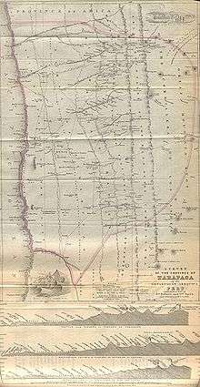
1851 map of Tarapacá Province
Political division
In 1878, this province was divided into the following districts.
- Tarapacá District
- Mamiña District
- Chiapa District
- Sibaya District
- Camiña District
gollark: Oh, or rewrite it in Haskell and use as many monads as possible.
gollark: Well, you could make it more annoying by having your code execute entirely out of order.
gollark: This is not really, as far as I know, practical for machine-code-y systems, because they don't need to go through a function call or whatever to load new code for execution.
gollark: What I had to do one time to reverse some obfuscated code on potatOS was hook `load` to log newly loaded code to a file, it's called "Protocol Epsilon debug mode" and is still in there.
gollark: I'm assuming you don't mean "polymorphism" in the sense of "functions which can take/return multiple types"?
References
- Vergara, Jorge Iván; Gundermann, Hans (2012). "Constitution and internal dynamics of the regional identitary in Tarapacá and Los Lagos, Chile". Chungara (in Spanish). University of Tarapacá. 44 (1): 115–134.
External links
- Gallery Peruvian from Tarapaca
- Peruvian from Tarapacá
- Providing that in the provinces of Tacna and Tarapaca, forming a Departamento Litoral
- Separating from the department of Moquegua province of Tarapacá under the name provincia litoral
- The new Departamento of Tarapacá
- Peruvian "Heros of Tarapaca" – brief synopsis of Battle of Tarapaca (in Spanish, from Website of Peruvian military central command)
This article is issued from Wikipedia. The text is licensed under Creative Commons - Attribution - Sharealike. Additional terms may apply for the media files.