Tank Subdivision
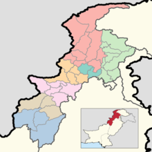
Tank Subdivision formerly Frontier Region Tank is a subdivision in Khyber Pakhtunkhwa province of Pakistan. The region is named after Tank District which lies to the south-east and also borders South Waziristan to the north, south and west and Lakki Marwat District to the north-east.[2] The capital is Jandola however it is administered by the district coordination officer (DCO) of Tank District.[3]
Tank ټانک | |
|---|---|
Subdivision | |
.jpg) Location of the former Frontier Regions in the former Federally Administered Tribal Areas | |
| Country | |
| Region | |
| Headquarters | Jandola |
| Population | |
| • Total | 36,389 |
Geography and climate
The region is mostly covered by the dry Bhittani hills, gradually sloping from north-west towards south-east.[2] The highest point of the region is 1,943 m (6,375 ft) above sea level. Most of the streams which originate from the region are seasonal and normally end up in the arid plains of Dera Ismail Khan District.[2]
The region experiences hot summers and cold winters.[2] The summer season is from April to October with June, July and August as the hottest months.[2] The winter season is from November to March with December, January and February as the coldest months.[2]
Demography
The 1998 census counted a total population of 27,200.[4]:5 Pashto is the first language of 97.5% of the population, and seraiki – of 2.1%.[4]:6 The main tribe in the region is the Bhittani, who also inhabit the frontier regions of Dera Ismail Khan and Bannu.[2]
Notable people
References
- "DISTRICT WISE CENSUS RESULTS CENSUS 2017" (PDF). www.pbscensus.gov.pk.
- "Historical and administrative profile of the FR Tank". FATA Secretariat. Archived from the original on December 3, 2009. Retrieved 2010-04-05.
- "Administrative System". FATA Secretariat. Archived from the original on March 30, 2010. Retrieved 2010-04-05.
- 1998 census report of Tribal Area Adjoining Tank District. Census publication. 149. Islamabad: Population Census Organization, Statistics Division, Government of Pakistan. 2001.
