Tafjord
Tafjord is a village in Fjord Municipality in Møre og Romsdal county, Norway. The village is in a valley located at the end of the Tafjorden, about 12 kilometres (7.5 mi) southeast of the municipal centre of Sylte, and just west of the borders of Reinheimen National Park. In the park, the mountains Tordsnose, Karitinden, and Puttegga all lie about 15 kilometres (9.3 mi) to the southeast of Tafjord in the Tafjordfjella mountain range.
Tafjord | |
|---|---|
Village | |
Towards Tafjord from Norddalsfjord | |
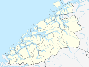
 Tafjord Location in Møre og Romsdal  Tafjord Tafjord (Norway) | |
| Coordinates: 62.2324°N 7.4177°E | |
| Country | Norway |
| Region | Western Norway |
| County | Møre og Romsdal |
| District | Sunnmøre |
| Municipality | Fjord Municipality |
| Elevation | 6 m (20 ft) |
| Time zone | UTC+01:00 (CET) |
| • Summer (DST) | UTC+02:00 (CEST) |
| Post Code | 6213 Tafjord |
The village is very isolated and (other than by boat) the only way into the valley is by road from the village of Sylte. The road is composed almost entirely of two tunnels through the very steep mountains along the edge of the Tafjorden: the 5.3-kilometre (3.3 mi) Heggur Tunnel and the 700-metre (2,300 ft) long Skjegghammar Tunnel.[2]
The weather station in Tafjord holds several temperature records. The highest ever recorded temperature in January in Norway and all of Scandinavia at 17.9 °C (64.2 °F) and also the highest ever recorded temperature in Norway in November at 21.8 °C (71.2 °F). These records are primarily due to foehn wind. In April 1937, the monthly average was 9.5 °C (49.1 °F) in Tafjord, the warmest April ever recorded in Norway.[3]
Tafjord rockslide disaster
On 7 April 1934, a rockslide of about 2,000,000 cubic metres (2,600,000 cu yd) of rock fell off the mountain Langhamaren from a height of about 700 metres (2,300 ft). The rock landed in the Tafjorden which created a local tsunami which killed 34 people[4] living on the shore of the fjord. The waves reached a height of 62 metres (203 ft) near the landslide, about 7 metres (23 ft) at Sylte, and about 16 metres (52 ft) at Tafjord. It was one of the worst natural disasters in Norway in the 20th century.[2]
References
- "Tafjord, Norddal (Møre og Romsdal)". yr.no. Retrieved 2019-08-18.
- Store norske leksikon. "Tafjord" (in Norwegian). Retrieved 2010-10-11.
- Mamen, Jostein (2008). "Dypdykk i klimadatabasen. Rekorder og kuriositeter fra Meteorologisk institutts klimaarkiv". Naturen (in Norwegian). 2008 (6).
- Furseth, Astor (1985). Dommedagsfjellet. Tafjord 1934 (in Norwegian). Oslo: Gyldendal.