Swastika, Ontario
Swastika (/ˈswɒstɪkə/ or /swɒsˈtiːkə/) is a small community founded around a mining site in Northern Ontario, Canada in 1908. Today it is within the municipal boundaries of Kirkland Lake, Ontario.[1] It has frequently been noted on lists of unusual place names.[2]
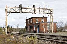
Swastika is a junction on the Ontario Northland Railway, where a branch to Rouyn-Noranda, Quebec leaves the ONR's main line from North Bay, Ontario to Moosonee. Until 2012, the Northlander passenger railway service between Toronto and Cochrane served the Swastika railway station with connecting bus service running along Highway 66 into downtown Kirkland Lake.[1]
History


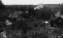
The town was named after the Swastika Gold Mine staked in the autumn of 1907 and incorporated on January 6, 1908.
James and William Dusty staked the claims alongside Otto Lake for the Tavistock Mining Partnership. Even though there is a legend that it is named after an Indian Sanskrit word for "Good luck", the gold mine and town were named after the Sanskrit good-luck symbol Swastika.[3] The Temiskaming and Northern Ontario Railway had an engineers' camp nearby as they had to construct two railway bridges as they advanced northwards. The first usage of the name Swastika occurred in their 1907 Annual Report to indicate a water tank was located at the site to meet the needs of the steam trains[4] that opened up northern Ontario.
Prospectors and miners flocked to the area and after viewing the find at the Swastika Gold Mine they advanced even further throughout the surrounding region. In 1909 the Lucky Cross Mine adjacent to the Temiskaming and Northern Ontario Railway tracks began producing gold. A Mr. Morrisson started a farm and lodging alongside the tracks as early as 1907 and from there the community developed.[4]
Swastika had a population of 450 by 1911, with the Lucky Cross and Swastika Mines in operation.[3]:33,79 By 1911, a hotel and businesses were flourishing, the area to the east was heavily staked and in 1912 the major gold mines of Kirkland Lake were found and developed by Harry Oakes. Swastika was the main transportation link with the railway and communications centre. Churches, schools, community groups and organisations continued to provide the needs of the residents of the area.[4]
The Swastika Mine was later called the Crescent Mine.[5]
In 2008, the small community of Swastika celebrated the town's centennial.
References
| Wikimedia Commons has media related to Swastika, Ontario. |
- "Swastika – Ontario Highway 11 Homepage". Highway11.ca. Archived from the original on May 22, 2009. Retrieved February 15, 2010.
- Parker, Quentin (2010). Welcome to Horneytown, North Carolina, Population: 15: An insider's guide to 201 of the world's weirdest and wildest places. Adams Media. pp. xii.
- Pain, S.A. (1960). Three Miles of Gold. Toronto: The Ryerson Press. pp. 9–10. ASIN B006JB1EFY.
- "Swastika Historical Plaque". Ontarioplaques.com. Archived from the original on March 14, 2010. Retrieved February 15, 2010.
- Barnes, Michael (1986). Fortunes in the Ground. Erin, Ontario: The Boston Mills Press. p. 171. ISBN 091978352X.