Superior Municipal Airport
Superior Municipal Airport (FAA LID: E81) is a public use non-towered airport located 2.3 miles (2.0 nmi; 3.7 km) southwest of the central business district of Superior, a city in Pinal County, Arizona, United States It is 52 miles (45 nmi; 84 km) east of Phoenix Sky Harbor International Airport.[1]
Superior Municipal Airport | |||||||||||
|---|---|---|---|---|---|---|---|---|---|---|---|
 | |||||||||||
| Summary | |||||||||||
| Airport type | Public | ||||||||||
| Owner/Operator | Town of Superior | ||||||||||
| Serves | Superior, Arizona | ||||||||||
| Elevation AMSL | 2,646 ft / 807 m | ||||||||||
| Coordinates | 33°16′40″N 111°07′37″W | ||||||||||
| Map | |||||||||||
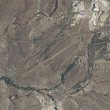
 E81  E81 | |||||||||||
| Runways | |||||||||||
| |||||||||||
| Statistics (2017) | |||||||||||
| |||||||||||
Source: Federal Aviation Administration | |||||||||||
Although most U.S. airports use the same three-letter location identifier for the FAA, IATA, and ICAO, Superior Municipal Airport is only assigned E81 by the FAA.[2]
Facilities and aircraft
Superior Municipal Airport covers an area of 265 acres (107 ha) at an elevation of 2,646 ft (807 m) above mean sea level. It has one gravel runway:
- 4/22 measuring 3,250 ft × 75 ft (991 m × 23 m)[3]
For the 12-month period ending April 22, 2017, the airport had 200 aircraft operations, an average of 0.6 per day: 100% general aviation. At that time there were no aircraft based at this airport.
References
- "AirportIQ 5010". www.gcr1.com. Retrieved 2018-05-09.
- "E81 - Superior [Muni], AZ, US - Airport - Great Circle Mapper". www.gcmap.com. Retrieved 2018-05-09.
- "AirNav: E81 - Superior Municipal Airport". www.airnav.com. Retrieved 2018-05-09.
External links
- Superior Municipal Airport (E81) at Arizona DOT airport directory
- FAA Terminal Procedures for E81, effective August 13, 2020
- Resources for this airport:
- FAA airport information for E81
- AirNav airport information for KE81
- FlightAware airport information and live flight tracker
- NOAA/NWS weather observations: current, past three days
- SkyVector aeronautical chart, Terminal Procedures