Stockhorn (Zermatt)
The Stockhorn (3,532 m) is a mountain of the Swiss Pennine Alps, located to the southeast of the town of Zermatt. It lies on the range between the Findel and Gorner glaciers, east of the Gornergrat.
| Stockhorn | |
|---|---|
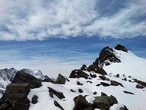 View from the east side | |
| Highest point | |
| Elevation | 3,532 m (11,588 ft) |
| Prominence | 145 m (476 ft) [1] |
| Parent peak | Monte Rosa (Dufourspitze) |
| Coordinates | 45°59′8″N 7°50′16″E |
| Geography | |
 Stockhorn Location in Switzerland | |
| Location | Valais, Switzerland |
| Parent range | Pennine Alps |
The Stockhorn is part of the Zermatt ski area. A now-defunct cable car station at an altitude of 3,405 m is located west of the summit; the original aerial tramway connecting the Gornergrat to the Stockhorn via Hohtälli was dismantled in 2007.[2][3]
References
- Retrieved from the Swisstopo topographic maps. The key col is the Stockhornpass (3,387 m).
- Stockhorn lifts on Seilbahn Nostalgie (in German)
- End of Gornergrat tram service - Funimag.com
This article is issued from Wikipedia. The text is licensed under Creative Commons - Attribution - Sharealike. Additional terms may apply for the media files.