Staatsmijn Emma
The Staatsmijn Emma was a Dutch coal mine located in Treebeek (now part of Brunssum) and Hoensbroek (now part of Heerlen). The mine was in operation from 1911 till 1973.
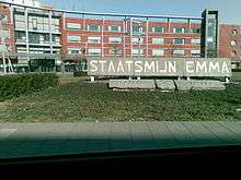 Monument of the Staatsmijn Emma | |
| Location | |
|---|---|
 Staatsmijn Emma | |
| Location | Hoensbroek |
| Limburg | |
| Country | Netherlands |
| Coordinates | 50°55′45″N 5°56′39″E |
| Production | |
| Products | Coal |
| Production | 109,032,000 tons |
| History | |
| Opened | 1911 |
| Closed | 1973 |
| Owner | |
| Company | DSM |
The second-largest mine in the Netherlands, it had the highest production of all Dutch mines at 109 tonnes (120 short tons).
The deepest shaft was 980 metres (3,220 ft) deep, although after integration with Staatsmijn Hendrik the deepest shaft was 1,058 metres (3,471 ft) deep.
This article is issued from Wikipedia. The text is licensed under Creative Commons - Attribution - Sharealike. Additional terms may apply for the media files.