St Gwenfaen's Well
St Gwenfaen's Well (also known as Welsh: Ffynnon Gwenfaen, Welsh: Ffynnon Wenfaen and Welsh: Ffynnon Gwenfai) is an early medieval holy well in the south west of Holy Island, Anglesey, named after St Gwenfaen, whose cloister was nearby. The site includes substantial remains of a building and is both a scheduled monument and a Grade II listed building. Traditionally, a gift of two white quartz pebbles thrown into the pool can cure mental health problems.
| Ffynnon Gwenfaen | |
|---|---|
| St Gwenfaen's Well | |
.jpg) Remains of well building | |
| Type | holy well |
| Location | Anglesey, Wales |
| Coordinates | 53.247°N 4.610°W |
| OS grid reference | SH 2595 7544 |
| Community | Rhoscolyn |
| Principal area | Anglesey |
| Official name: Ffynnon Gwenfaen | |
| Designated | 16 July 1987 |
| Reference no. | AN055 |
Listed Building – Grade II | |
| Official name: Ffynnon Gwenfai | |
| Designated | 5 April 1971 |
| Reference no. | 5328 |
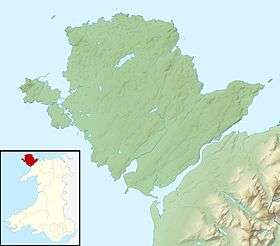
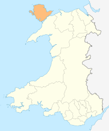
 Location in Anglesey | |
Location
St Gwenfaen's Well lies in an isolated position in a cleft in the rock in a dell overlooking the cliffs of Porth Gwalch (Welsh: Hawk Bay) in the community of Rhoscolyn in the south west of Holy Island, Anglesey.[1][2][3] The well is just under 1 km (0.6 miles) west by south west of the village of Rhoscolyn which is the location of St Gwenfaen's Church, part of the ministry area of Holy Island (Church in Wales).[1][4][5]
As with much of Holy Island, the well lies within the area of the Glannau Ynys Gybi (Welsh: Holy Island Coast) Site of Special Scientific Interest and the Anglesey Area of Outstanding Natural Beauty.[6][7]
Description
The remains of the drystone well house are 4.5 m (15 feet) east-west by (originally) 5.5 m (18 feet) north-south. Three steps descend into the building from the east into a 2.0 m (6.6 feet) square chamber with a flagstone floor and four diagonal stone seats in each corner. A narrow opening and steps lead into the rectangular well chamber, 1.2 m (3.9 feet) east-west by 0.6 m (2.0 feet) north-south, with recessed semi-circular seats at each side.[1][2][3][8]
An outer external well chamber roughly 1.5 m (4.9 feet) square contains the well itself, and is separated from the internal well chamber by a drystone wall, which includes a stone slab with circular grooves cut in its upper and lower edges to allow water to flow between the two chambers. The external chamber can be reached by six descending stone steps on either side cut into the cleft in the rock.[1][2][3][8]
At the western end a stone slab with a hole allows water to be retained in the chamber or be released into a 4.6 m (15 feet) long paved channel leading to a pool 35 m (115 feet) west of the well.[1][2]
St Gwenfaen's Well has not been accurately dated but is assumed to be medieval. The nearby church dedicated to St Gwenfaen is on the site of an older church dating from 630 AD.[4][2]
History and legend
Gwenfaen was the daughter of Paul Hen of Manaw (who also known as Old Paulinus), and sister of Peulan and Gwyngeneu, both saints who also lived on Holy Island. She was known for healing mental illness. While being chased by druids, Gwenfaen is said to have climbed a nearby rock stack and was carried away by angels when the tide came in.[4][9]
An offering of two white quartz pebbles into the water of the well is said to cure mental problems.[4]
Recent history
St Gwenfaen's Well was designated as a Grade II listed building in 1971 and as a scheduled monument in 1987.[1][10]
The well is blessed every year on, or near, Gwenfaen's Saint's day, 4 November, after Holy Communion in the nearby church.[4][11]
Access
St Gwenfaen's Well can be reached by footpath, either by a circular route around Rhoscolyn or by following the Anglesey Coastal Path (part of the Wales Coast Path).[12][13]
See also
- List of Scheduled Monuments in Anglesey
- St Allgo's Well
- St Seiriol's Well
References
- "Ffynnon Gwenfai". Statutory List of Buildings. Cadw. 3 June 1998 [Listed 5 April 1971]. Cadw Building ID 5328. Retrieved 24 June 2017 – via Historic Wales.
- Wiles, John (3 August 2007). "St Gwenfaens Well; Ffynnon Wenfaen". National Monuments Record of Wales (NMRW). Royal Commission on the Ancient and Historical Monuments of Wales (RCAHMW). NPRN 32172. Retrieved 14 May 2016 – via coflein (online database of the NMRW).CS1 maint: ref=harv (link)
- "Ffynnon Gwenfaen Holy Well, Rhoscolyn". Historic Environment Record (HER). Gwynedd Archaeological Trust (GAT). GAT PRN 2004. Retrieved 14 May 2016 – via archwilio (online database of the four Welsh Archaeological Trusts).
- "Welcome to St Gwenfaen's Church". stgwenfaen.org. Retrieved 14 May 2016.
- "St Gwenfaen, Rhoscolyn". Church in Wales. Retrieved 15 May 2016.
- Grant, Maria; Parker, Sally (April 2014). State of the AONB Report for Anglesey (PDF). Isle of Anglesey County Council (Report). Land Use Consultants. p. 11. Retrieved 14 May 2016.
- Ratcliffe, John. "Glannau Ynys Gybi – Holyhead Coast SSSI". Anglesey Nature: Natur Môn. Retrieved 14 May 2016.
- Royal Commission on Ancient and Historical Monuments in Wales and Monmouthshire (1960) [1937]. 76 Rhoscolyn. An Inventory of the Ancient Monuments in Anglesey. London: HMSO. p. 146. OCLC 631587260 – via google play.
- Maddern, Eric (October 2015). Snowdonia Folk Tales. Illustrated by Sue Mynall. Stroud, Gloucester: The History Press. pp. 35–6. ISBN 9780750966429. OCLC 948249400. Retrieved 15 May 2016.
- Ffynnon Gwenfaen. National Monuments Record of Wales (NMRW) (Report). Cadw. 16 July 1987 [Scheduled 1987]. Cadw Id: AN055.
- "Rhoscolyn". Snowdonia Guide. Retrieved 15 May 2016.
- "Circular Walk – Rhoscolyn (SH271751)" (PDF). visitanglesey.co.uk. Isle of Anglesey County Council. Retrieved 15 May 2016.
- Dillon, Paddy (2015). "Stage 11 South Stack to Fourmilebridge". The Wales Coast Path: Llwybr Arfordir Cymru. Milnthorpe, Cumbria: Cicerone Press. ISBN 978-1-85284-742-5. OCLC 897884010. Retrieved 15 May 2016.
Further reading
- Jones, Francis (2003) [1954]. The Holy Wells of Wales (2nd ed.). University of Wales Press. ISBN 978-0708311455. OCLC 39985359.
- Breverton, Terry (2010). Wales' 1000 Best Heritage Sites. Stroud, Gloucester: Amberley Publishing. ISBN 978-1-8486-8991-6. OCLC 713568411.
External links
- "Map 9 – Rhoscolyn" (PDF) (Map). visitanglesey.co.uk. 1:25,000. Isle of Anglesey County Council. – map of part of Anglesey Area of Outstanding Natural Beauty
- "St Gwenfaens Well; Ffynnon Wenfaen". coflein. RCAHMW. – online images
- "St Gwenfaens Well". The Megalithic Portal. – gallery of photos including close-ups of features
- "North Wales". The Orthodox Church in Cumbria. The Orthodox Parish of Sts Bega, Mungo, and Herbert, Keswick, Cumbria. – shrines, churches and wells associated with Welsh saints
- "Map B Ynys Môn – Isle of Anglesey" (PDF). Wales Coast Path. National Resources Wales. – includes Maps 13 to 28 covering the coast of Anglesey
