Spitzmeilen
The Spitzmeilen is a mountain of the Glarus Alps, lying on the border between the Swiss cantons of Glarus and St. Gallen. It lies between the valleys of Schilstal and Sernftal.[2]
| Spitzmeilen | |
|---|---|
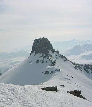 Spitzmeilen as seen from the northwest | |
| Highest point | |
| Elevation | 2,501 m (8,205 ft) |
| Prominence | 86 m (282 ft) [1] |
| Parent peak | Magerrain |
| Coordinates | 47°1′26.5″N 9°14′11″E |
| Geography | |
 Spitzmeilen Location in Switzerland | |
| Location | Glarus/St. Gallen, Switzerland |
| Parent range | Glarus Alps |
References
- Retrieved from the Swisstopo topographic maps and Google Earth. The key col is located west of the summit at 2,415 metres.
- map.geo.admin.ch (Map). Swiss Confederation. Retrieved 29 May 2015.
This article is issued from Wikipedia. The text is licensed under Creative Commons - Attribution - Sharealike. Additional terms may apply for the media files.