Spit Point (Greenwich Island)
Spit Point (62°31′32″S 59°47′18.5″W) is a narrow gravel spit forming the south side of the entrance to Yankee Harbor, Greenwich Island, in the South Shetland Islands, situated at the end of Provadiya Hook. The point was known to early sealers in the area and roughly charted on Powell's map of 1822. It was recharted by DI personnel on the Discovery II in 1935 and given this descriptive name.

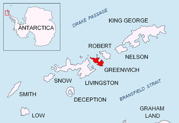
Location of Greenwich Island in the South Shetland Islands.
Provadiya Hook from Shopski Cove, with Spit Point at its left extremity and Oborishte Ridge in the background.

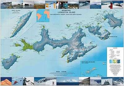
Topographic map of Livingston Island, Greenwich, Robert, Snow and Smith Islands.
Maps
- L.L. Ivanov et al. Antarctica: Livingston Island and Greenwich Island, South Shetland Islands. Scale 1:100000 topographic map. Sofia: Antarctic Place-names Commission of Bulgaria, 2005.
- L.L. Ivanov. Antarctica: Livingston Island and Greenwich, Robert, Snow and Smith Islands. Scale 1:120000 topographic map. Troyan: Manfred Wörner Foundation, 2009. ISBN 978-954-92032-6-4
gollark: You're more likely to be elected if you're better at manipulating people/are charismatic/whatever, and the amount of people who actually notice "hey, this law is impossible to implement and stupid" is much smaller than the amount of voters.
gollark: Well, the political system does select for people like that a bit...
gollark: You know, if you think about it, all these explanations are terrible for everyone else (well, in Australia, or actually most western countries). Yay!
gollark: That anti-encryption law.
gollark: I find it really hard to believe that Australia's government is *accidentally* this stupid.
References
![]()
![]()
This article is issued from Wikipedia. The text is licensed under Creative Commons - Attribution - Sharealike. Additional terms may apply for the media files.