Sovetskoye Highway
Sovetskoye Highway (Russian: Советское шоссе) is a street in Novosibirsk and its suburbs. It connects the Kirovsky and Sovetsky districts of the city, Krasnoobsk and some other settlements. Its length is 9.5 km (5.9 mi).[1]
 | |
| Native name | Советское шоссе |
|---|---|
| Length | 9.5 km (5.9 mi) |
| Location | Novosibirsk Russia |
The highway starts from Zatulinsky Microdistrict, runs through Novosibirsky District and ends at the intersection of Primorskaya, Chasovaya and Ivlev streets of ObGES Microdistrict.
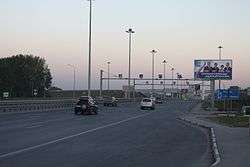
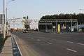
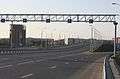
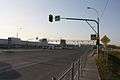
Gallery

gollark: They can just print upgrades/maintenance into themselves directly.
gollark: Why would those require *ink* to operate?
gollark: Naturally.
gollark: Precisely as planned, of course.
gollark: No comment. However, consider the possibility of rustaceous hyperspeed iterated prisoners' dilemma engines in the hands of GTech™.
See also
References
- 9,5 км, 2 млрд рублей, 36 тысяч автомобилей в сутки – открывается сквозное движение по Советскому шоссе. Новосибирские новости. October 12, 2011.
- После реконструкции Советское шоссе стало интеллектуальным. ФедералПресс. After the reconstruction, Sovetskoye Highway became smart. FederalPress. September 14, 2012.
- Развязка на улице Петухова, которую строили три года, открылась в Новосибирске. Комсомольская правда. The junction that built three years was opened in Novosibirsk. Komsomolskaya Pravda. September 8, 2015.
This article is issued from Wikipedia. The text is licensed under Creative Commons - Attribution - Sharealike. Additional terms may apply for the media files.