South Fork Catawba River
The South Fork Catawba River (better known as the South Fork River)[5] begins south of Hickory, North Carolina just northwest of the intersection of US Highway 321 and North Carolina Highway 10, at the confluence of the Henry Fork and Jacob Fork. The South Fork Catawba River travels 48.5 miles, passing along the communities of Lincolnton, High Shoals, McAdenville, and Cramerton, to Lake Wylie where its now submerged confluence with the Catawba River lies near the North Carolina and South Carolina border.
| South Fork Catawba River Tributary to Catawba River | |
|---|---|
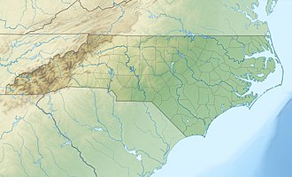
 Location of South Fork Catawba River mouth  South Fork Catawba River (the United States) | |
| Location | |
| Country | United States |
| State | North Carolina |
| County | Catawba Gaston Lincoln |
| City | Lincolnton McAdenville Cramerton Belmont |
| Physical characteristics | |
| Source | confluence of Henry Fork and Jacob Fork |
| • location | about 2 miles west of Startown, North Carolina |
| • coordinates | 35°38′09″N 081°18′29″W[1] |
| • elevation | 798 ft (243 m)[2] |
| Mouth | Catawba River |
• location | Lake Wylie |
• coordinates | 35°08′59″N 081°01′58″W[1] |
• elevation | 569 ft (173 m)[2] |
| Length | 54.96 mi (88.45 km)[3] |
| Basin size | 660.78 square miles (1,711.4 km2)[4] |
| Discharge | |
| • location | Catawba River (Lake Wylie) |
| • average | 843.05 cu ft/s (23.873 m3/s) at mouth with Catawba River[4] |
| Basin features | |
| Progression | southeast |
| River system | Catawba River |
| Tributaries | |
| • left | Henry Fork Clark Creek Muddy Creek Lithia Branch Hoyle Creek |
| • right | Jacob Fork Pott Creek Howards Creek Indian Creek Beaverdam Creek Sulphur Branch Rattle Shoal Creek Coley Creek Long Creek DuHarts Creek |
| Waterbodies | Lake Wylie |
| Bridges | NC 10, Blackburn Bridge Road, Reepsville Road, S Grove Street, US 321, Laboratory Road, South Fork Road, Long Shoals Road, US 321, S Lincoln Street, Hardin Road, Philadelphia Church Road, Dallas Stanley Highway, Stanley-Spencer Mountain Road, I-85, Hickory Grove Road, US 74, North Main Street, Armstrong Ford Road, Armstrong Road |
Signage on roadways crossing the river acknowledge it as the "South Fork River".
The river is part of the Santee River Watershed.
Variant names
According to the Geographic Names Information System, it has also been known historically as:[1]
- Little Catawba River
- South Fork
- South Fork River
- South Fork of the Catawbaw River
gollark: What device are you trying to use it with, I mean?
gollark: <@!258639553357676545> what
gollark: <@593113791252660224> What exactly are you trying to do?
gollark: https://osmarks.tk/emu-war/Try the new Emu War game, contributed by <@!332271551481118732>. Looking at the code should probably be avoided (some offense).
gollark: You can postpone mine. I like game theory.
See also
- List of North Carolina rivers
References
- "GNIS Detail - South Fork Catawba River". geonames.usgs.gov. US Geological Survey. Retrieved 14 October 2019.
- "South Fork Catawba River Topo Map, Gaston County NC (Belmont Area)". TopoZone. Locality, LLC. Retrieved 14 October 2019.
- "ArcGIS Web Application". epa.maps.arcgis.com. US EPA. Retrieved 14 October 2019.
- "South Fork Catawba River Watershed Report". Waters Geoviewer. US EPA. Retrieved 14 October 2019.
- "South Fork Catawba River". Geographic Names Information System. United States Geological Survey. Retrieved April 26, 2014.
This article is issued from Wikipedia. The text is licensed under Creative Commons - Attribution - Sharealike. Additional terms may apply for the media files.