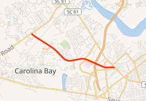
South Carolina Highway 461
South Carolina Highway 461 (SC 461) is a 3.7-mile-long (6.0 km) state highway in the U.S. state of South Carolina. The highway is completely within the West Ashley portion of Charleston.
| ||||
|---|---|---|---|---|

| ||||
| Route information | ||||
| Maintained by SCDOT | ||||
| Length | 3.71 mi[1] (5.97 km) | |||
| Major junctions | ||||
| South end | ||||
| North end | Bees Ferry Road in Charleston | |||
| Location | ||||
| Counties | Charleston | |||
| Highway system | ||||
| ||||
Route description
SC 461 begins at an intersection with SC 61 (Ashley River Road) in the West Ashley portion of Charleston, Charleston County. Here it is known as Paul Cantrell Boulevard. It travels to the west and immediately curves to the west-northwest before an interchange with Interstate 526 (I-526; Mark Clark Expressway). At an intersection with Magwood Drive, the highway takes on the Glenn McConnell Parkway name. It passes southwest of West Ashley Park and northeast of West Ashley High School. The highway crosses over some railroad tracks just before it meets its northern terminus, an intersection with Bees Ferry Road.[2]
Major intersections
The entire route is in Charleston, Charleston County.
| mi[1] | km | Destinations | Notes | ||
|---|---|---|---|---|---|
| 0.00 | 0.00 | Southern terminus | |||
| 0.64– 0.92 | 1.03– 1.48 | I-526 exit 11; no access from SC 461 north to I-526 west | |||
| 3.71 | 5.97 | Northern trminus | |||
| 1.000 mi = 1.609 km; 1.000 km = 0.621 mi | |||||
See also


References
- "Statewide Highways (shapefile)" (zip). South Carolina Department of Transportation. September 29, 2017. Retrieved December 8, 2017.
- Google (May 16, 2016). "South Carolina Highway 461" (Map). Google Maps. Google. Retrieved May 16, 2016.
External links

- SC 461 South Carolina Hwy Index
