South Carolina Highway 288
South Carolina Highway 288 (SC 288) is a 15.3-mile-long (24.6 km) state highway in the U.S. state of South Carolina. The highway connects Pumpkintown and Slater-Marietta.
| ||||
|---|---|---|---|---|
| ||||
| Route information | ||||
| Maintained by SCDOT | ||||
| Length | 15.26 mi[1] (24.56 km) | |||
| Major junctions | ||||
| West end | ||||
| East end | ||||
| Location | ||||
| Counties | Pickens, Greenville | |||
| Highway system | ||||
| ||||

Route description
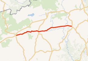
SC 288 begins at an intersection with U.S. Route 178 (US 178; Moorefield Memorial Highway) east-northeast of Sunset within Pickens County. It travels to the east-northeast and crosses the Oolenoy River and Mill Creek. Farther to the east is a crossing of Carrick Creek just before entering Pumpkintown. There, it intersects SC 8 (Pumpkintown Highway). Just to the east of town is a crossing of Weaver Creek. Then, the highway crosses over Gowens Creek and curves to the east just before going over the South Saluda River. This river marks the Greenville County. Just before it enters Slater-Marietta, it crosses the Middle Saluda River. Very shortly after entering town, it meets its eastern terminus, an intersection with US 276 (Geer Highway). This intersection is just to the east of Slater Marietta Elementary School and Jimi Turner Park.[2]
Major intersections
| County | Location | mi[2] | km | Destinations | Notes |
|---|---|---|---|---|---|
| Pickens | | 0.00 | 0.00 | ||
| Pumpkintown | 6.24 | 10.04 | |||
| Greenville | Slater-Marietta | 15.26 | 24.56 | ||
1.000 mi = 1.609 km; 1.000 km = 0.621 mi
| |||||
See also


References
- "Statewide Highways (shapefile)" (zip). South Carolina Department of Transportation. September 29, 2017. Retrieved December 8, 2017.
- Google (May 13, 2016). "South Carolina Highway 288" (Map). Google Maps. Google. Retrieved May 13, 2016.
External links

- SC 288 South Carolina Hwy Index