Solent Rescue
Solent Rescue is an independent inshore rescue lifeboat, not run by the RNLI, based at Lepe Country Park south of the New Forest, on the north shore of the Solent in the county of Hampshire in England.[1]
| Solent Rescue | |
|---|---|
 View to the west from the Solent Rescue Lifeboat Station lookout towards the old coastguard cottages and Beaulieu river entrance. | |
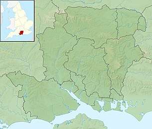 Location of Solent Rescue Lifeboat station within Hampshire | |
| General information | |
| Type | RNLI Lifeboat Station |
| Location | New Forest, South East England, Hampshire |
| Country | England |
| Coordinates | 50°47′06.4″N 1°21′41.4″W |
| Owner | Independent Rescue Organisation |
Description
This small independent rescue organisation was set up in 1971 as a beach rescue unit, and has now developed into a full lifeboat station. The organisation operates within a specified area as agreed with Her Majesty's Coastguard. This covers 33 square miles (85 km2) of water and spans from Cowes in the Central Solent to Hurst Castle in the western fringes of this inshore waterway. Solent Rescue is one of seven independent lifeboats who make up the Solent Sea Rescue Organisation; each of these units have equipment that is tailor-made or selected for their unique areas of operation.
2011 to 2016 improvements
Alterations were undertaken at Solent Rescue during this time and the following assets were replaced:
- Clifftop weatherproof observation lookout.
- The main lifeboat was replaced with a 7.9-metre Delta rigid-hulled inflatable boat, powered by twin Suzuki DF90 lean burn engines. This has reduced response times.
- The old boat shed was replaced.
During 2017 and 2019
Solent Rescue obtained a 9-metre cabin lifeboat which would allow crew to head out in almost all weather states.
Furthermore, additional support assets were been purchased with the aim to be able to utilize these to assist in times of inland adverse weather conditions within Hampshire along with close SAR support to Lepe and Stanswood beach fronts.
2020 and beyond
With a generous donation from Sidmouth lifeboat, Solent Rescue returned to operating an open RIB far superior to any such vessel that they had previously operated in addition to the D-class they are able to provide good coverage
Neighbouring station locations
Neighbouring stations to Solent Rescue | ||||||||||
|---|---|---|---|---|---|---|---|---|---|---|
| ||||||||||
References
- OS Explorer Map – 119 - Meon Valley, Portsmouth, Gosport and Fareham, Showing part of the South Downs Way (Folded Map). Published: Ordnance Survey; A2 edition (15 February 2010). ISBN 978 03192 412 40