Solari Bay
Solari Bay (Bulgarian: залив Солари, ‘Zaliv Solari’ \'za-liv so-'la-ri\) is the 11.2 km wide bay indenting for 4.5 km Nordenskjöld Coast in Graham Land north of Balvan Point and south of the east extremity of Richard Knoll. It was formed as a result of the break-up of Larsen Ice Shelf in the area in the late 20th century, and subsequent retreat of Drygalski Glacier. The feature is named after the settlement of Solari in Northern Bulgaria.
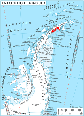
Location of Nordenskjöld Coast on Antarctic Peninsula.
Location
Solari Bay is located at 64°44′30″S 60°43′00″W.
Maps
- Antarctic Digital Database (ADD). Scale 1:250000 topographic map of Antarctica. Scientific Committee on Antarctic Research (SCAR). Since 1993, regularly upgraded and updated.
gollark: Yes, I checked with the potatOS install on your computer, that is faked.
gollark: It doesn't seem to be in the debian repos.
gollark: I have an ethics machine which makes any decision I make objectively ethical.
gollark: While I believe the set of people who knows my views is well-defined, I don't know who's in it.
gollark: You don't know my views. NOBODY knows my views. Except those who know my views, and I think they're quite knowable.
References
- Solari Bay. SCAR Composite Antarctic Gazetteer.
- Bulgarian Antarctic Gazetteer. Antarctic Place-names Commission. (details in Bulgarian, basic data in English)
External links
- Solari Bay. Copernix satellite image
This article includes information from the Antarctic Place-names Commission of Bulgaria which is used with permission.
This article is issued from Wikipedia. The text is licensed under Creative Commons - Attribution - Sharealike. Additional terms may apply for the media files.