Sokongen Island
Sokongen (Danish: Søkongen Ø) is an island in the Sermersooq municipality, in eastern Greenland. .
| Søkongen Ø | |
|---|---|
 Sokongen | |
| Geography | |
| Location | Greenland Sea |
| Coordinates | 68°10′N 30°45′W |
| Area | 115 km2 (44 sq mi) |
| Administration | |
| Municipality | Sermersooq |
| Demographics | |
| Population | 0 |
Geography
Sokongen is a coastal island that lies between the Nansen Fjord to the northeast and the J.A.D. Jensen Fjord to the southwest. It is located in an indented area of the eastern Greenland shore where there is a succession of headlands with active glaciers in between.[1]
The island is 26 kilometres (16 miles) in length and its maximum width is 15 kilometres (9 miles).[2] Its SE headland is Cape J.A.D. Jensen (68°10'N., 29°48'W.), a massive rocky promontory with steep dark basalt cliffs rising almost 1,000 over the sea, located 15 km to the SW of Cape Nansen.[3]
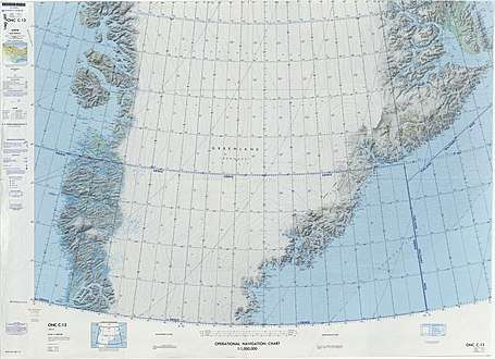 Map of Greenland section. |
gollark: But if you ask "hey, random person, would you be willing to give up some amount of money/resources/etc to stop people dying of malaria", people will just mostly say no.
gollark: If you *ask* someone "hey, random person, would you like people in Africa to not die of malaria", they will obviously say yes. Abstractly speaking, people don't want people elsewhere to die of malaria.
gollark: Capitalism is why we have a massively effective (okay, mostly, some things are bad and need fixing, like intellectual property) economic engine here which can produce tons of stuff people want. But people *do not care* about diverting that to help faraway people they can't see.
gollark: Helping people elsewhere does mean somewhat fewer resources available here, and broadly speaking people do not actually want to make that tradeoff.
gollark: You don't particularly need that. You can just buy a cheaper phone and give charity £400 or something.
See also
References
- Prostar Sailing Directions 2005 Greenland and Iceland Enroute, p. 110
- GoogleEarth
- "Søkongen Ø". Mapcarta. Retrieved 10 April 2016.
External links
This article is issued from Wikipedia. The text is licensed under Creative Commons - Attribution - Sharealike. Additional terms may apply for the media files.