Sint Antoniesbreestraat
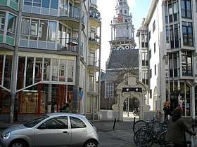
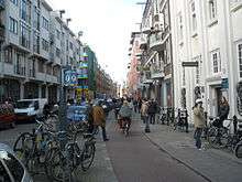
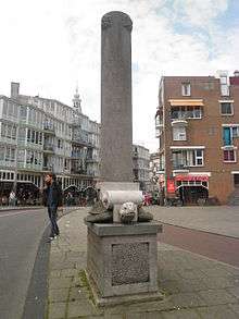
The Sint Antoniesbreestraat ("St. Anthony's Broad Street") is a street in the centre of Amsterdam in the Netherlands. The street runs south from Nieuwmarkt square to the Sint Antoniesluis sluice gates, where it continues as the Jodenbreestraat. The Sint Antoniesbreestraat is primarily a shopping street with a variety of specialty shops. At the corner of Sint Antoniesbreestraat and Hoogstraat is an entry to the Nieuwmarkt stop of the Amsterdam Metro system.


History
The street was originally a dike, the Sint Antoniesdijk, constructed during the Middle Ages. It protected the city and its surroundings from flooding. After 1585 this part of the city, called the Lastage, was developed.
In the early 17th century, the street was popular with immigrants and artists such as the painter Rembrandt, who lived there from 1631 to 1635, at the home of art dealer Hendrick van Uylenburgh. (From 1639 to 1656 he lived in his own home, now the Rembrandt House Museum.) Other painters who lived in the street, near the Guild of Saint Luke in the former Sint Anthoniespoort, include Esaias Boursse, who lived next door to Rembrandt, Nicolaes Eliaszoon Pickenoy, Cornelis van der Voort, Roelant Savery, Pieter Lastman (in whose workshop Rembrandt served as apprentice), Adriaen van Nieulandt, Pieter Codde, Justus, Johannes Vingboons, their father David Vinckboons, Willem Kick. The burgomasters Geurt van Beuningen.[1] and Joan Huydecoper grew up here.
Isaac de Pinto's 17th-century house with an Italianate facade, the Huis De Pinto (or Pintohuis), still stands.[2] The property was purchased by Pinto in 1651 and was remodeled after 1686. Upon its renovation, the building was the "talk of the town" due to the dramatic style of exterior and interior.[3] Across from the De Pinto House is a gate giving access to the Zuiderkerkhof, the square where the Zuiderkerk church stands.
Since the 17th century, the section of the street south of the sluice and bridge has been called Jodenbreestraat ("Jewish Broad Street"). The straight and wide Jodenbreestraat runs through the former Jewish quarter of Amsterdam.[3] During World War II, many residents were taken away to the Nazi concentration camps and the neighbourhood was left practically deserted.
After the war, the abandoned houses were left in a decrepit state and many were torn down. Plans were made to build new houses, as well as a highway and metro line through the street. These plans were met by heavy rioting in 1975. (The highway plans were abandoned in 1972; the metro however was constructed.) New houses were built along the existing Sint Antoniesbreestraat, and the Huis de Pinto, which had become a symbol of the movement to save the neighbourhood, was renovated and now serves as public library.
References
- Flip ten Cate: Dit volckje seer verwoet: een geschiedenis van de Sint Antoniesbreestraat. Amsterdam: Pantheon, 1988. ISBN 90-72653-01-7
- http://www.jhm.nl/culture-and-history/amsterdam/the-de-pinto-house
- Martin Dunford (2010). The Rough Guide to The Netherlands. Penguin. p. 70. ISBN 978-1-84836-882-8.
| Wikimedia Commons has media related to Sint Antoniesbreestraat, Amsterdam. |